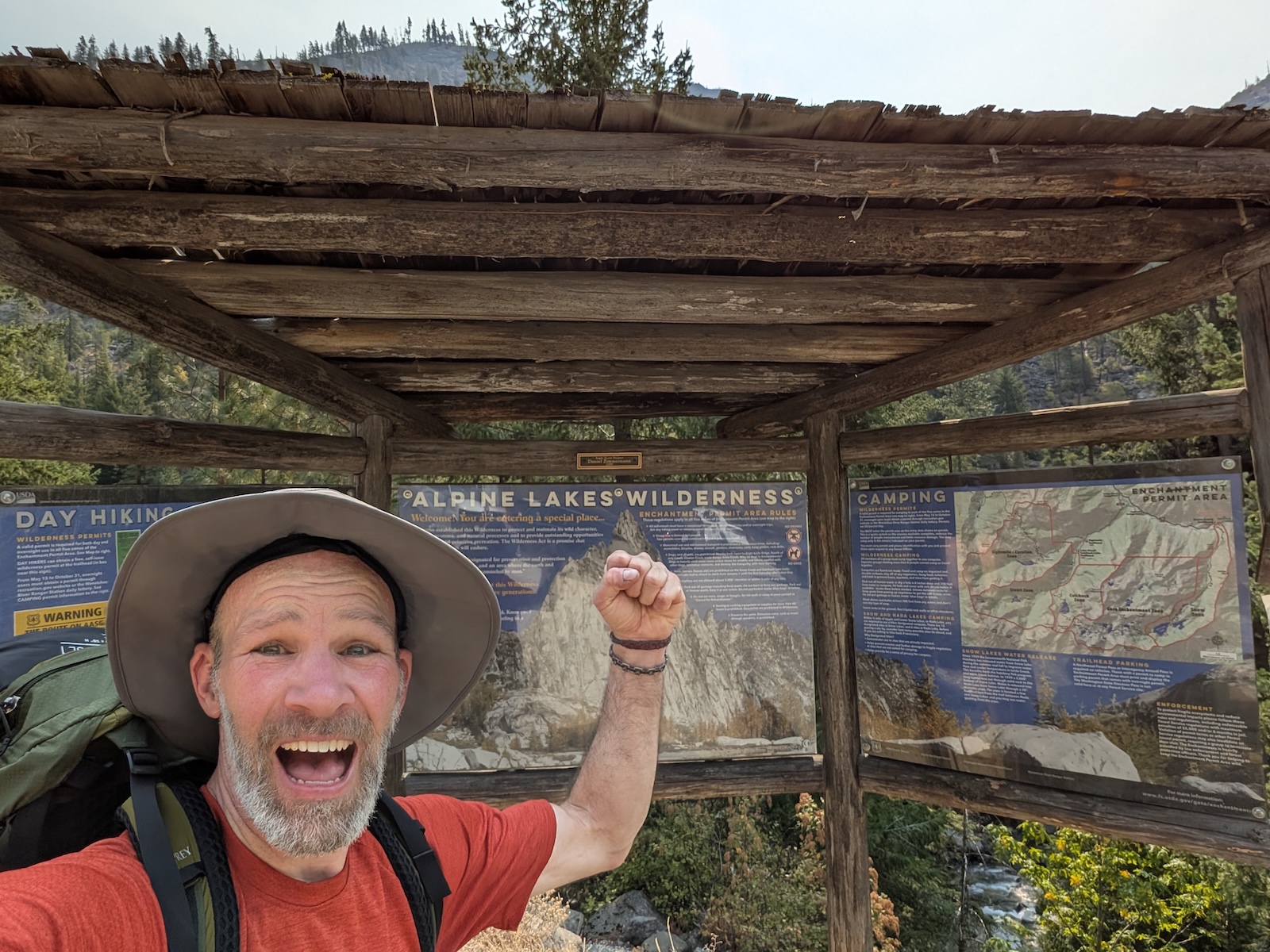
Backpacking The Enchantments, September 2025Living in Seattle offers easy access to the Washington Cascades (as well as the Olympics) for copious day-hiking and backpacking trips. I have backpacked in the Olympics (Staircase, Dosewallips, Enchanted Valley), the Northern Cascades (Sahale Glacier), and the Central Cascades (Trap Lack, Rampart Lakes). But in 2025 I won the infamous Enchantments Core Zone Lottery, and so in September of that year, I spent five days and four nights backpacking through Washington state's most famous backcountry destination. My original intended itinerary was a four-night, five-day trip, entering at the Stuart trailhead on Sunday and exiting at the Snow trailhead on Thursday:
However, research suggested that it was better advised to hike farther into the Core after ascending Asgard Pass. Furthermore, as the date of the trip approached, I debated adding a day, which I finally did (you have to pay $5/day in advance, when you finalize your permit, so there is a minor incentive to know or design your itinerary correctly in advance). So I headed out on the trip intending to do a five-night, six-day trip, with something like the following night stops:
However, once I got out there, my intended stopping points often didn't make sense as I moved along the main route. As I explored, I ended up helplessly ahead of my itinerary and ended up doing a four-by-five anyway, but nothing like the one intended above (I never left the tent in one place for two nights, for one thing, and I didn't sleep anywhere near the end of Nada Lake for another thing). I'll explain how that happened as I go along below, but in short, the following was my actual itinerary:
I now have a much better idea for itineries that would have worked better than the one I ended up doing. For a four night trip, I wish I had camped at Colchuck, Brisingamen, Inspiration or Perfection, and Upper Snow Lake, with a half-day trip up Annapurna. And for a five night trip, I would aim for camping at Colchuck, Brisingamen, Inspiration or Perfection, Leprechaun or Viviane, and Lower Nada, with half-day trips up both Annapurna and Prusik. Credit: I used gpx studio to visualize the GPX tracks recorded with Gaia on my Google Pixel 9. OverviewHere's the route I actually took once I was there, divided into major legs, either by day or by partial day (day hikes or things to that effect). Click any images on this webpage to enlarge: 
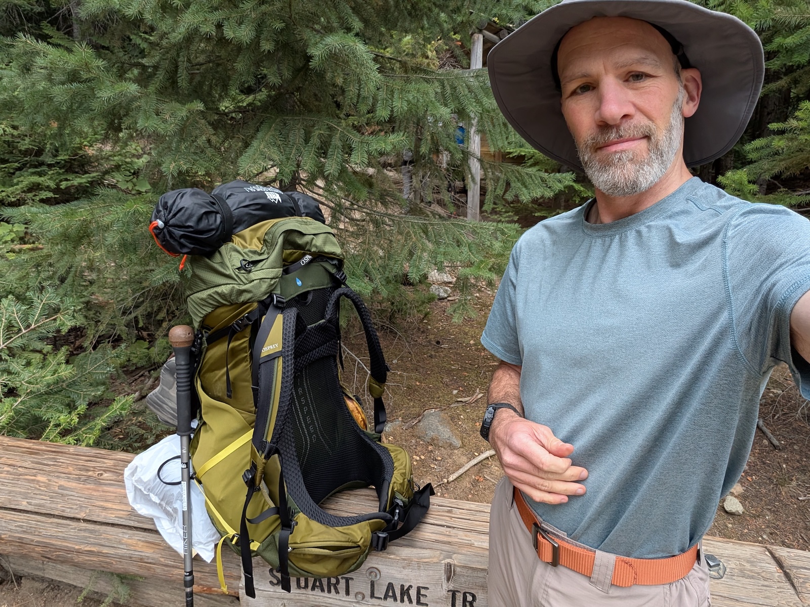
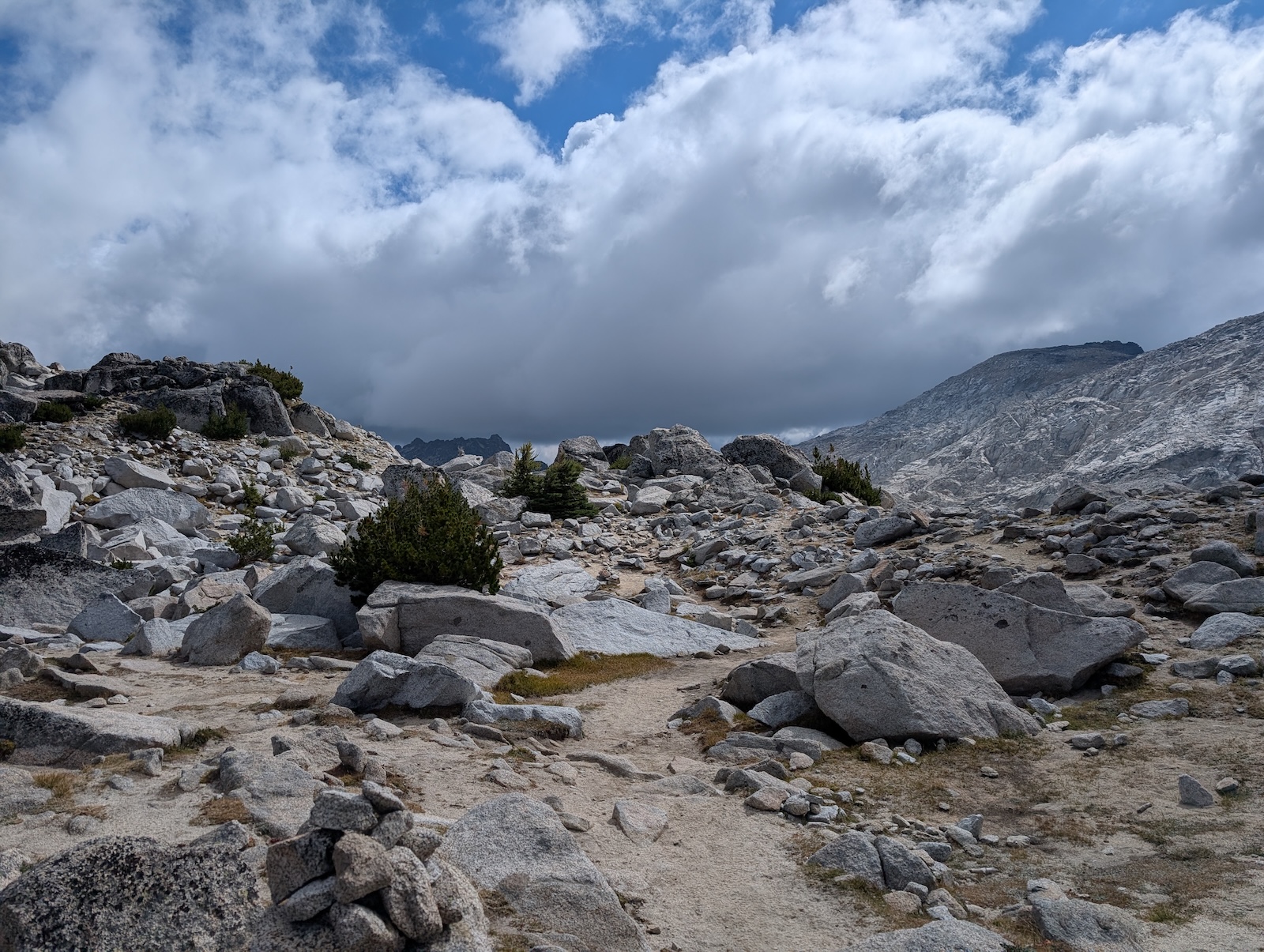
Almost everyone hikes the Enchantments from the Stuart end (at the left side of the map) to the Snow end. The main reason for doing it in that direction is that it involves a significant net loss of altitude (it is, overall, downhill), despite requiring one to ascend the formidable Asgard Pass (not that descending a steep talus field is necessarily easy; most hikers find long stretches of downhill pretty treachorous). Starting at Snow would be an uphill hike in final net. Day 0: Drive to the Snow Lake trailhead the evening before my permit dateSince the trail doesn't return to its starting point, all backpackers and day thru-hikers have to figure out how to get back to their car. With larger groups and multiple cars, the standard technique will work. For everyone else, a mixture of ad-hoc hitch-hiking and formal shuttles generally works. I used the Leavenworth Shuttle service, which costs $30 and can take you either direction at a few set times during the day. So, I slept in the back of my Forester (I have built an extension out of wood that fills in and levels the gap behind the front seats so that the entire back area is a flat sleeping surface) the night before my permit entry date. Then, at 7:30 AM, I jumped in the shuttle, along with a handful of other people, both backpackers with the same permit date as myself, and a few day hikers as well, and we rode to the Stuart trailhead. Day 1: From Stuart trailhead to Colchuck LakeThe hike started out retracing the very popular day hike to Colchuck Lake (but of course I didn't have to go back to the parking lot; I only had to hike half as far as a standard Colchuck day hike would involve). At times, this trail feels moderately steep, but on paper it isn't. Go figure. Everything felt harder with a thirty-five pound pack of course. 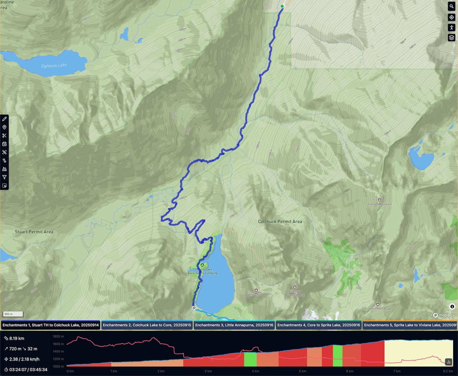
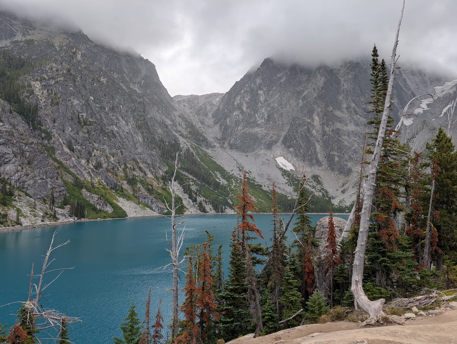
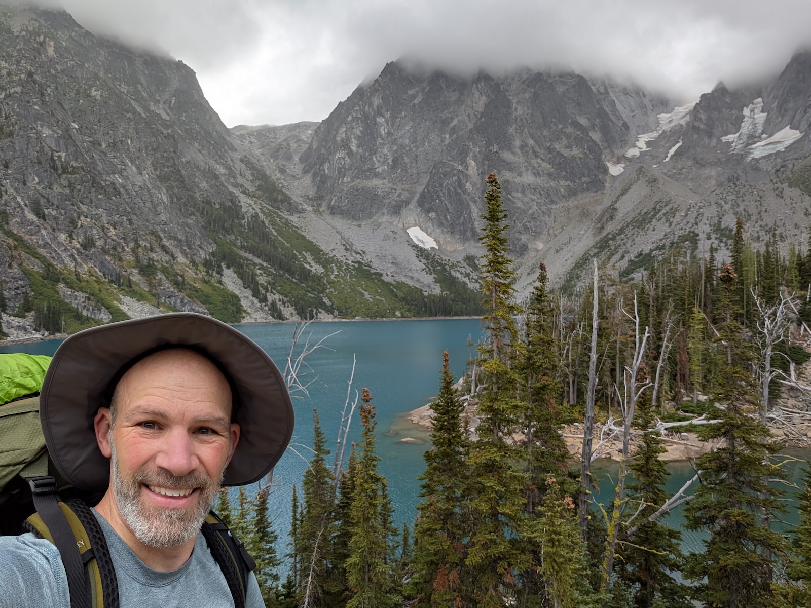
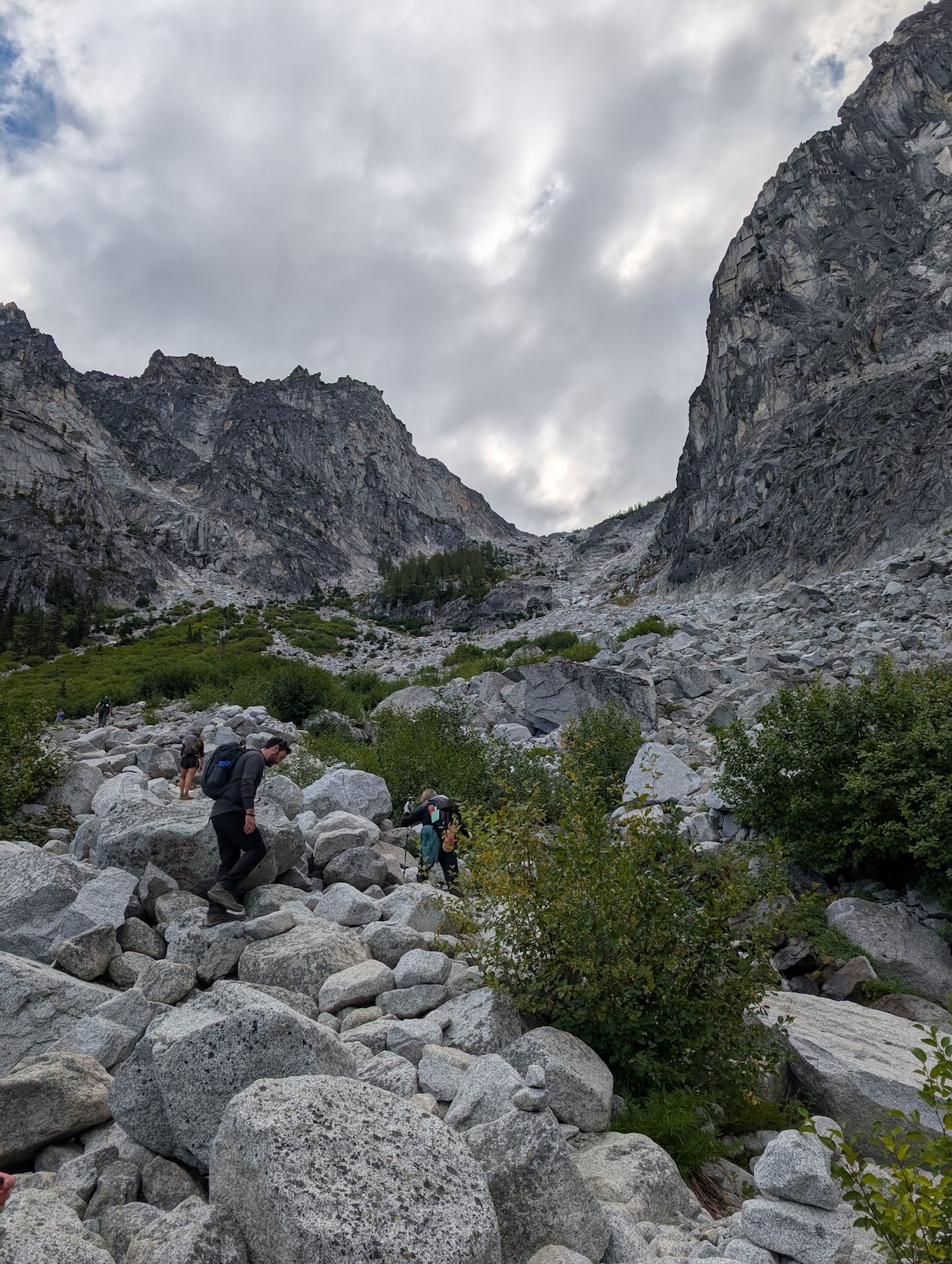
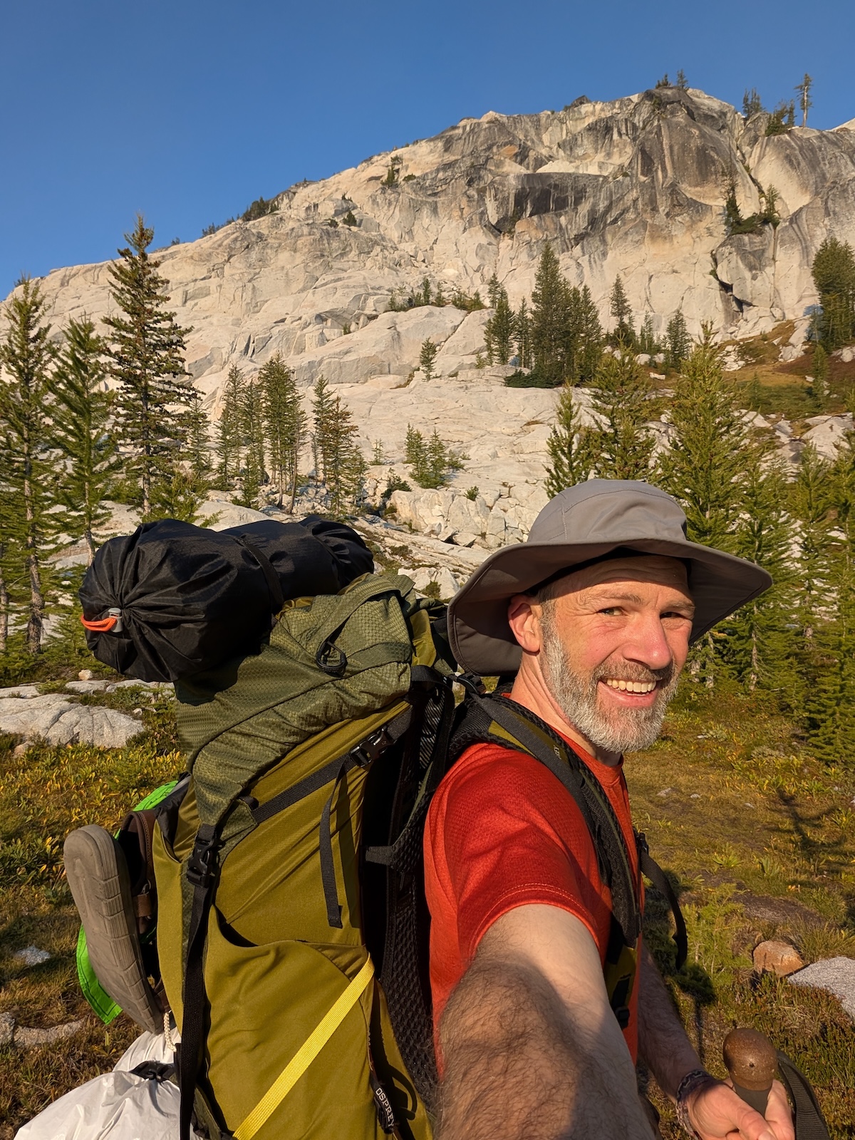
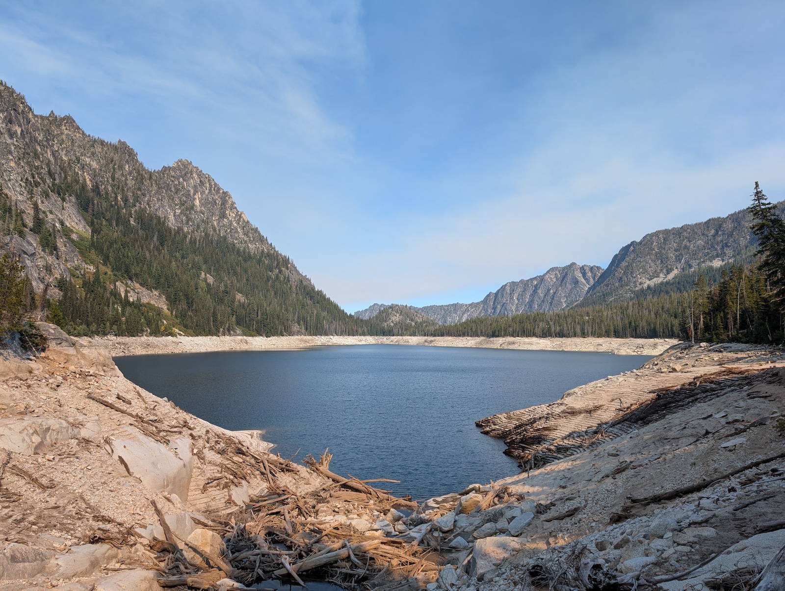
Day 2: Asgard PassAs per advice during my many months of research, I camped as far around Colchuck Lake as possible, right in the middle of the final talus field before Asgard Pass (not the talus field the pass itself consists of), so that the next morning I could launch straight into the notoriously hardest part of the route, Asgard Pass. The trail begins by going across the steep talus field at about a 45-degree angle to the left, crossing the main stream that comes down the pass. Once at the left edge of the talus field, the trail more or less goes straight up the pass the rest of the way, hugging the left cliff-wall of the pass. The trail consists of an even mix of very short switchbacks and direct, straight up the mountain, rock-hopping. The trail branches like crazy as people clearly have trouble keeping track of it and then wear down new trails all over the pass. There are cairns everywhere, but they don't mark the official trail so much as simply mark where people have gone — as it is popular to augment the cairns along one's own way, right or wrong. For my part, I tried to follow Gaia very closely, checking it continuously and heading off tempting trails ahead of me across seemingly untrailed talus to refind the official trail elsewhere. This technique almost always worked; I would indeed find the main trail once again. It is worth noting that there are two primary kinds of Enchantments hikers, backpackers and day-thru-hikers. The former won the infamous lottery, months in advance and against all odds, garnering the coveted overnight permits for camping. I won a Core permit, arguably the only kind of permit that enables one to truly experience the Enchantments properly. The odds of winning were a couple of percent at best. The day hikers, or thru-hikers, only need a self-issued day pass filled out at the trailhead and of no particular restriction (no lottery). But, since they aren't allowed to sleep for the night along the eighteen to twenty-two mile route, they must finish the entire thing in one day, and that includes features like Asgard Pass (plus some other very difficult sections). The reason I mention the two kinds of hikers is that they tend to carry very different equipment. On the one hand, the backpackers can take their time, only needing to cover a few miles a day (or even staying in one campsite for multiple nights). On the other hand, the day hikers tend to carry much lighter loads. My point is that while I was dragging about thirty-five pounds up Asgard Pass, the day hikers around me had ordinary backpacks with little more than some water and solid noms. I envied them desperately during this section of the trip. 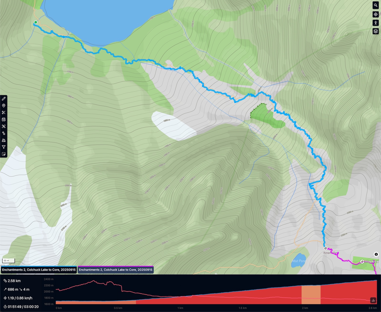
During my initial research, I presumed Asgard Pass's reputation implied I would be done by the time I got the top, but frankly, despite being very hard, it is also very short. I was done with it before lunch and had the rest of the day before me, plus it was mostly downhill from there on. So I continued onward. 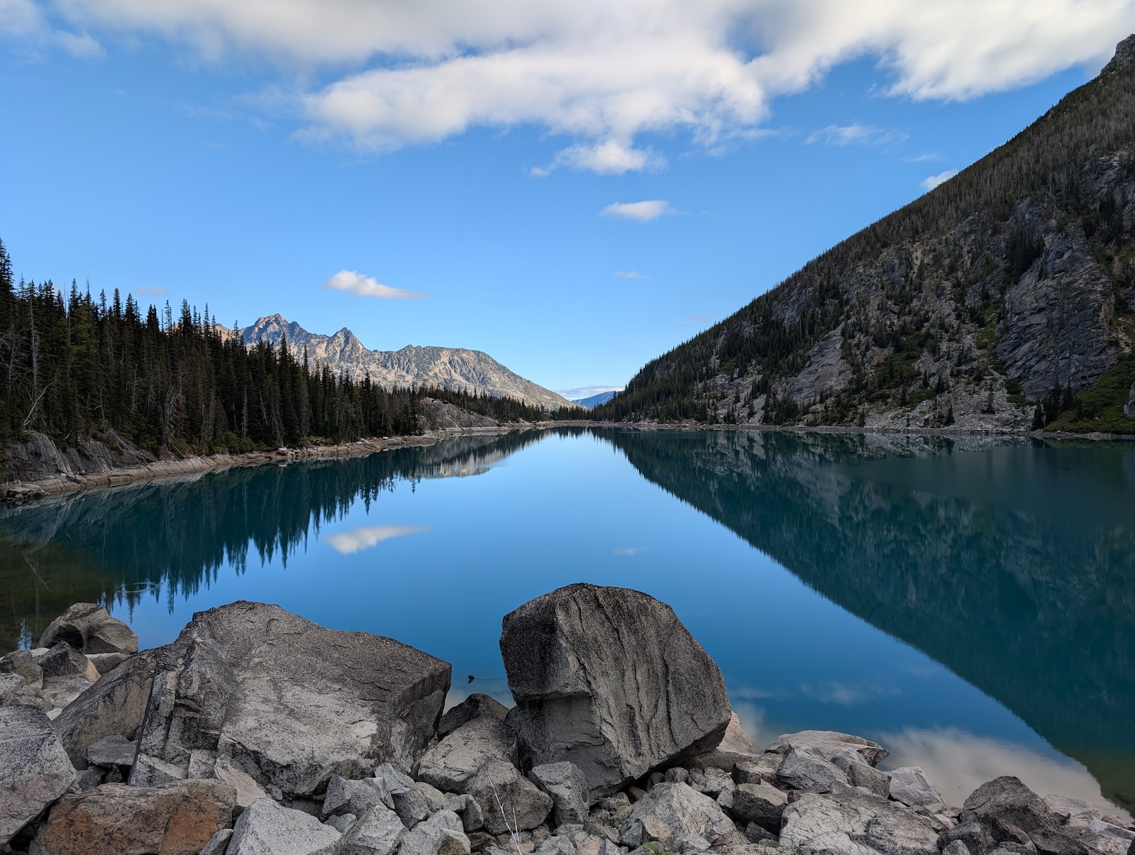
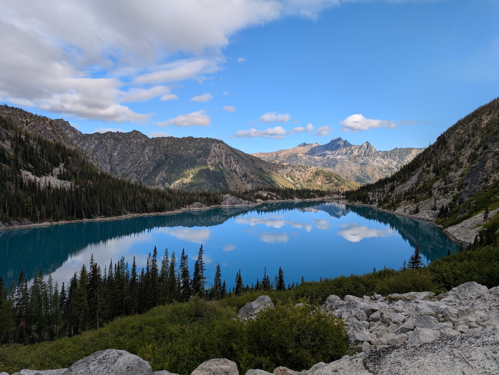
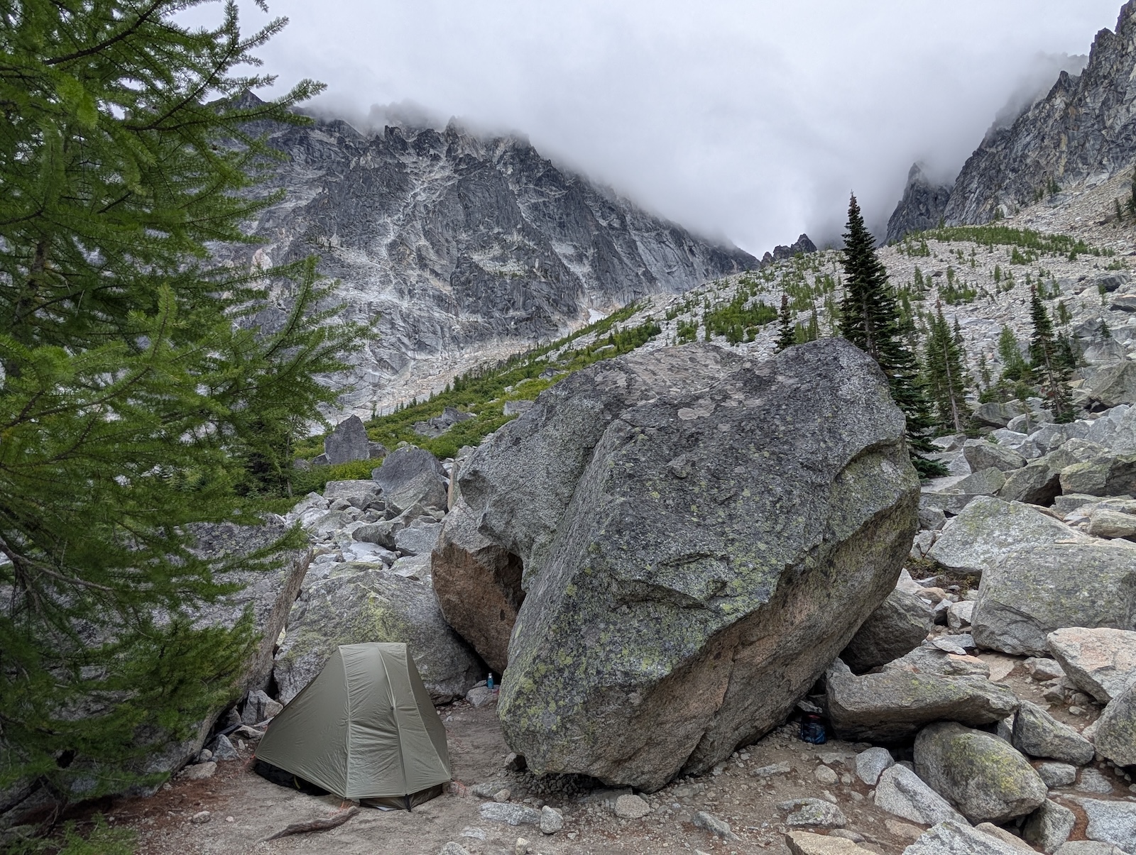
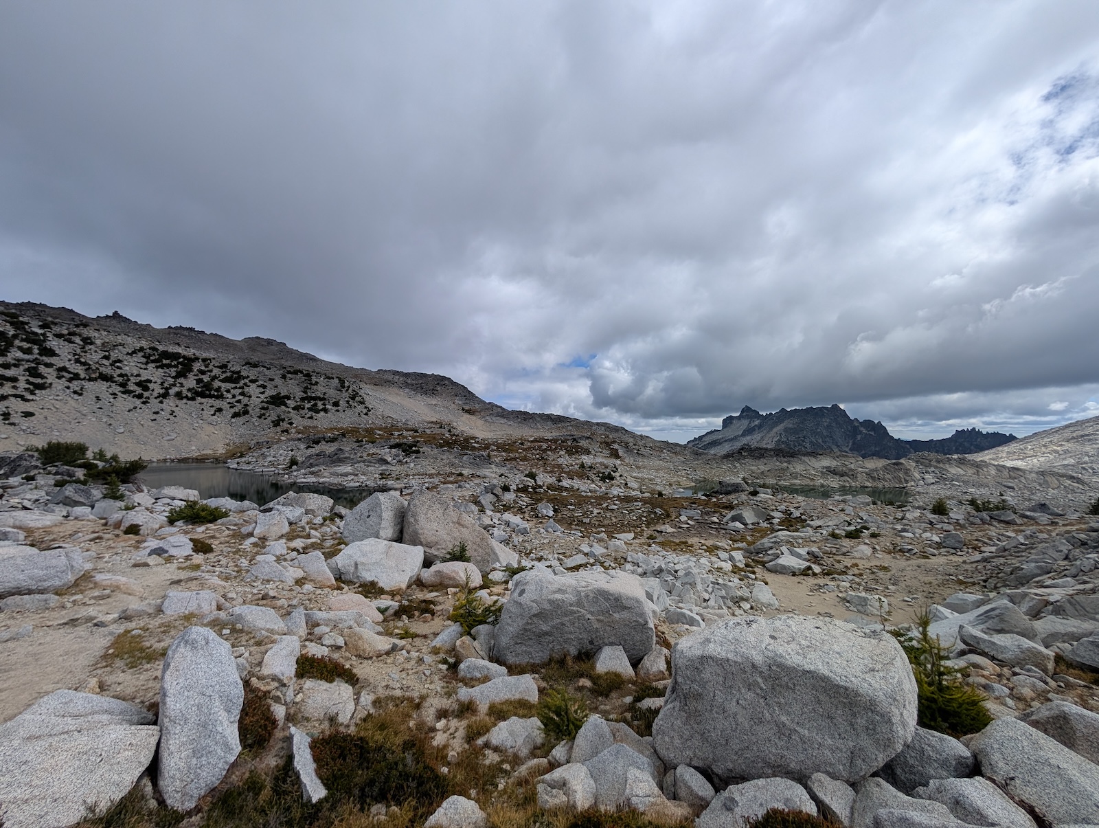
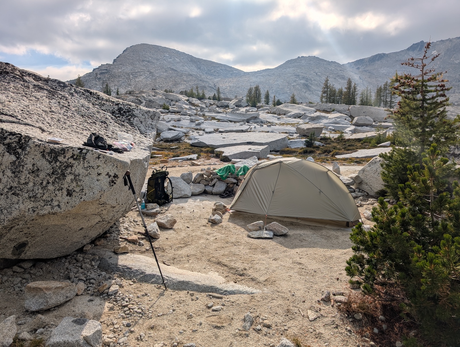
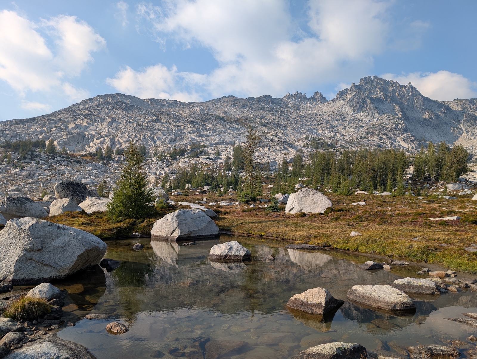
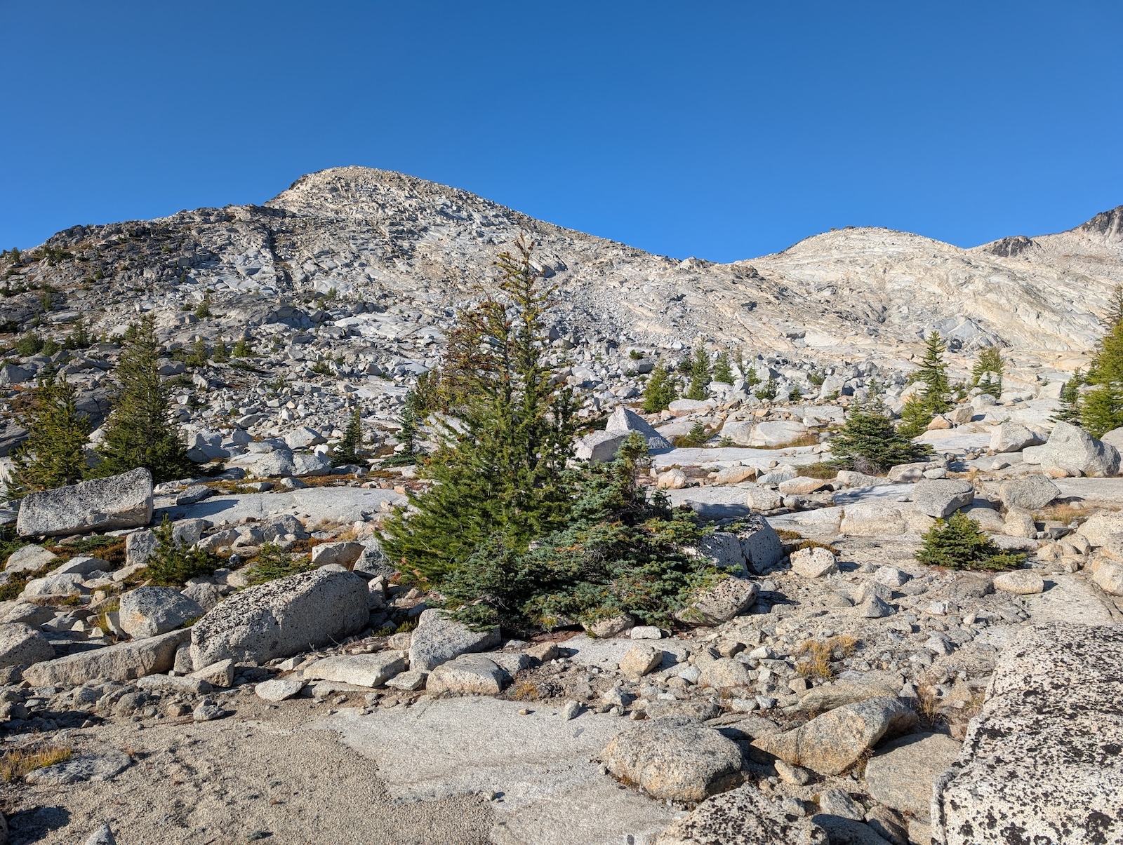
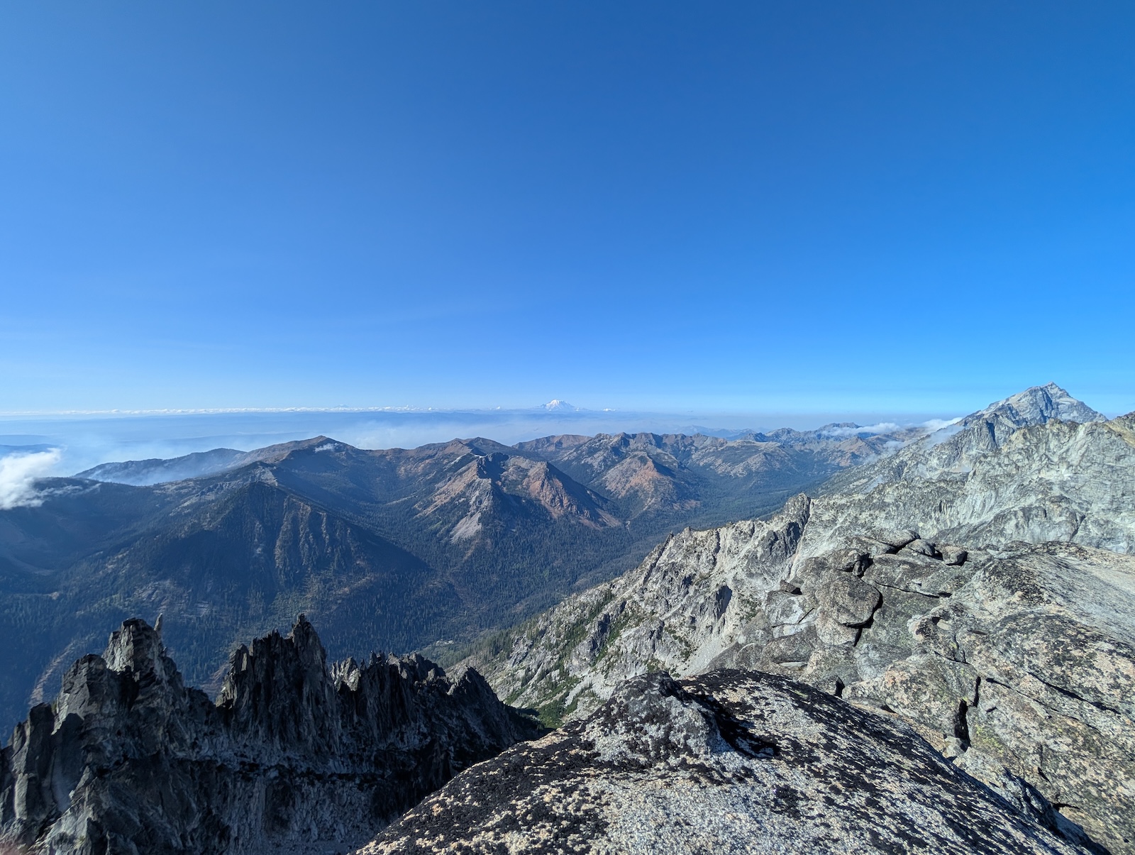
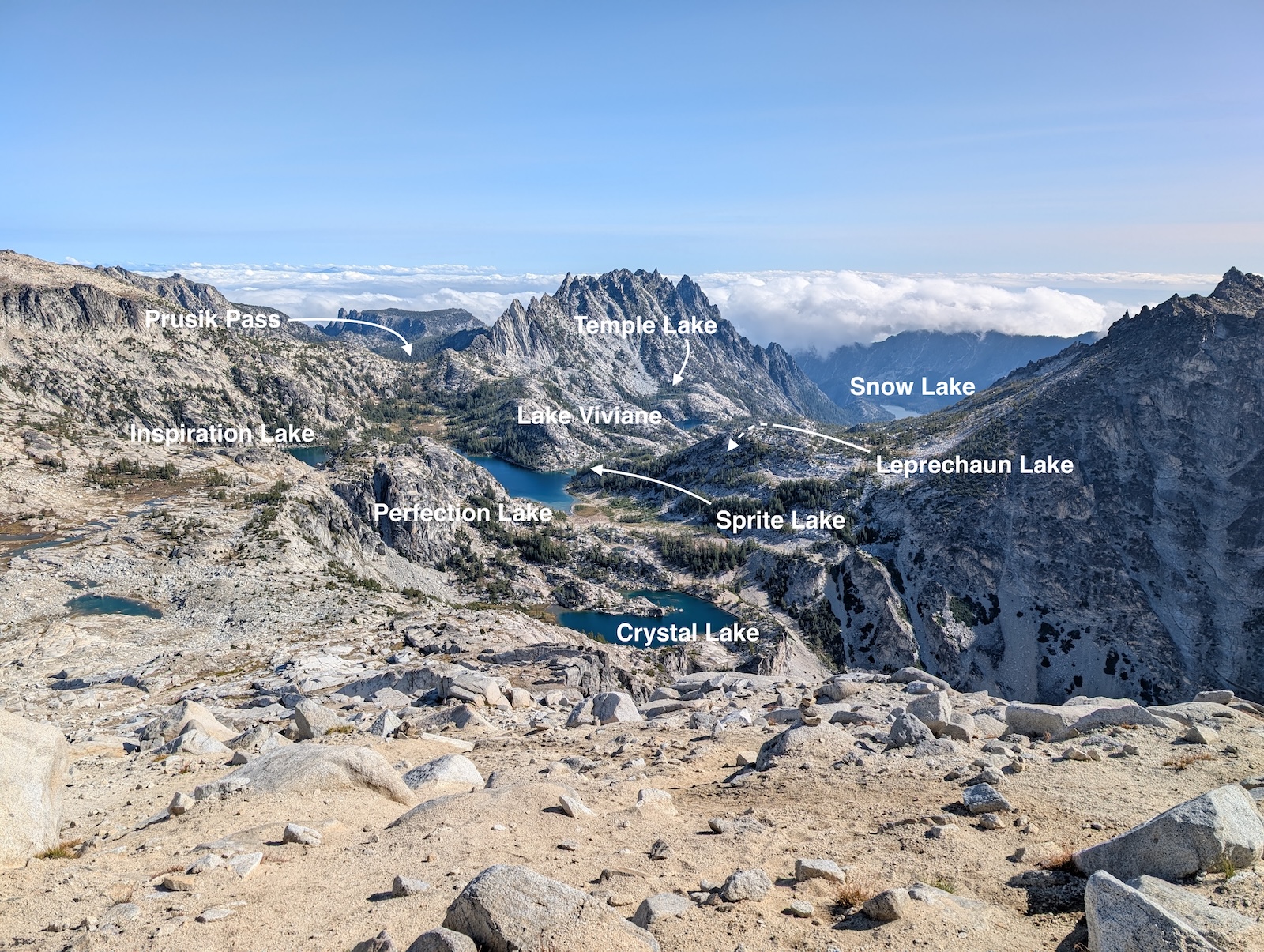
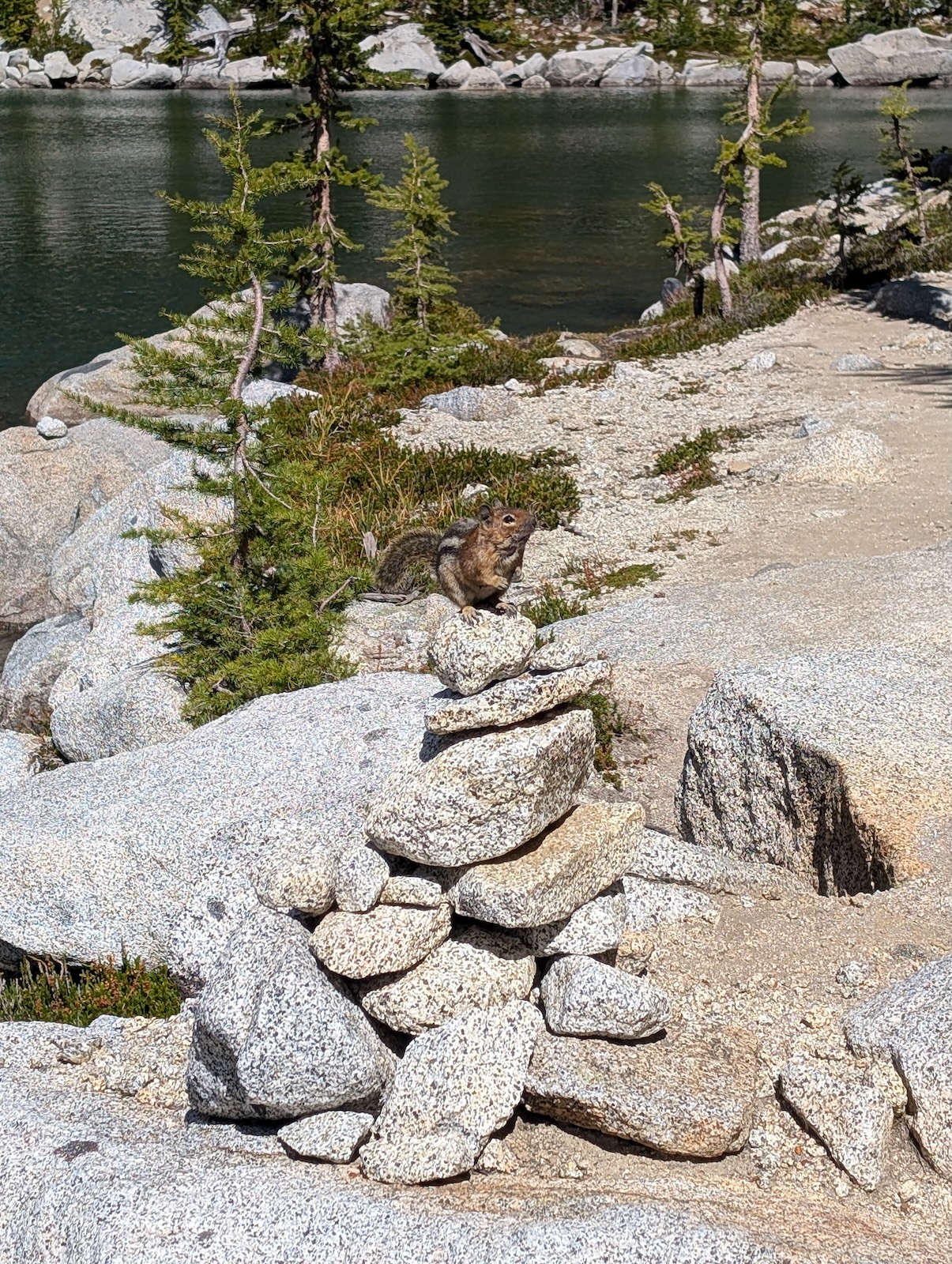
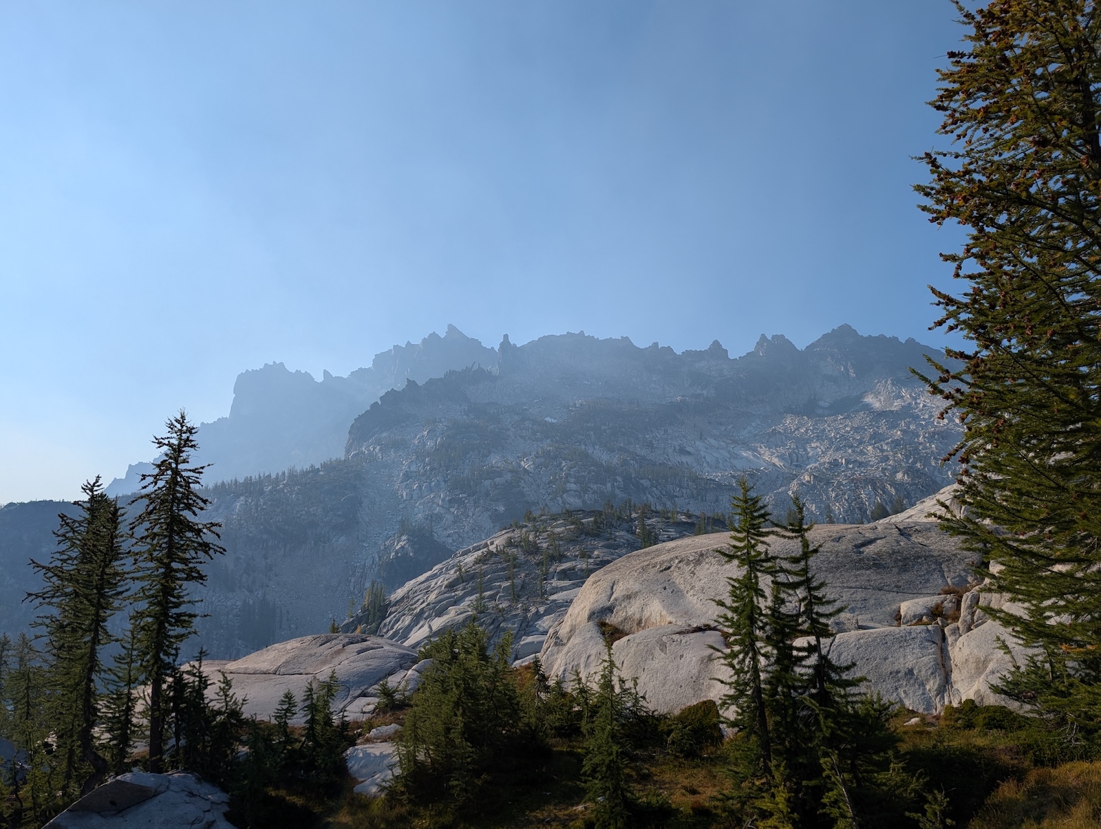
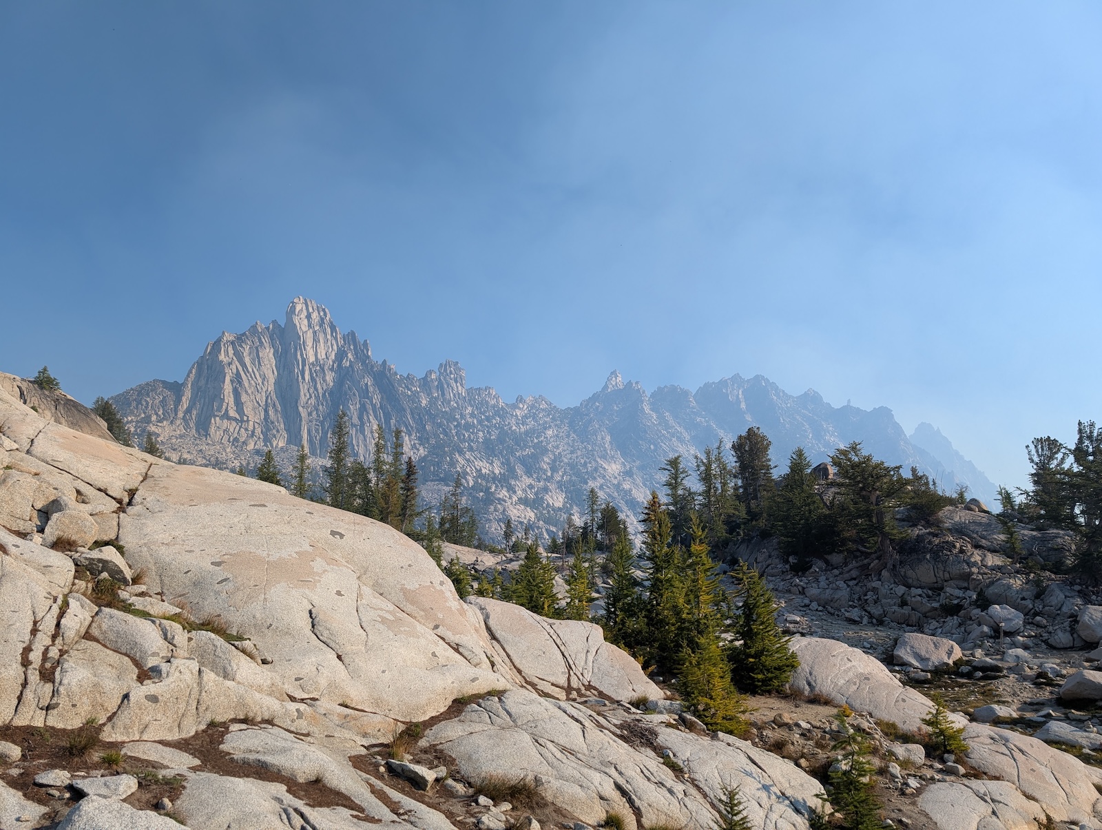
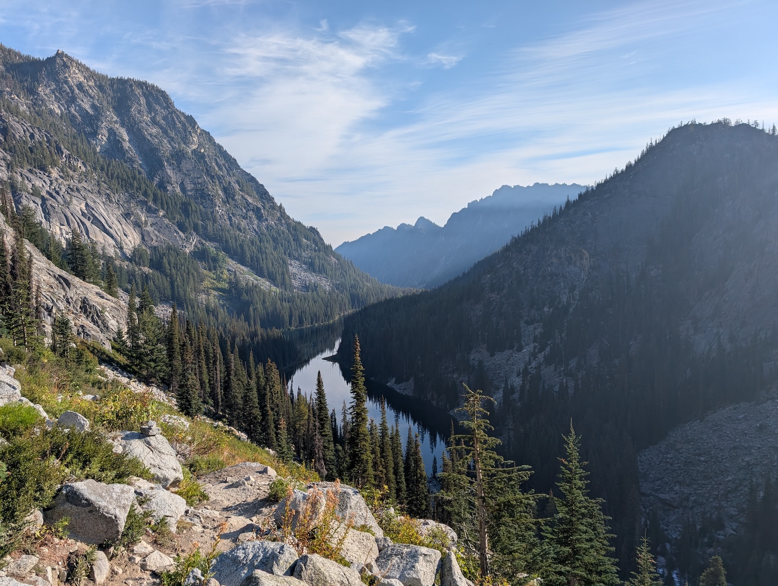
Day 2: From Asgard Pass into the Core and onto Brisingamen LakeletsStill day two, after ascending Asgard Pass, I ventured onward and found a beautiful area called the Brisingamen Lakelets. I had the entire area to myself for the rest of the afternoon and the following morning. Hikers came through along the trail periodically of course, but no one else hung around here, while I took all the time I wanted since camp was anchored at that point. I don't think anyone camped within a mile of me that night. After getting camp set up, I explored the lakelets and their meandering creeks for the afternoon. This was the highest point I would spend any significant time and it was just magical. 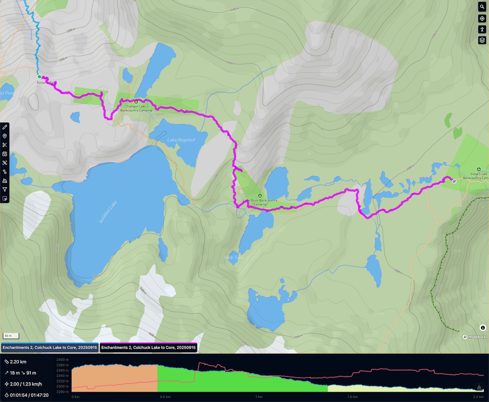
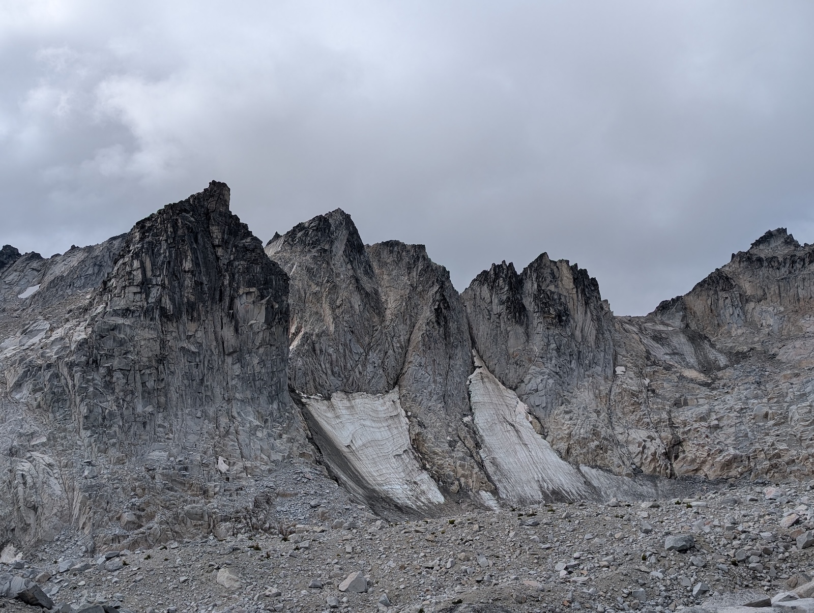
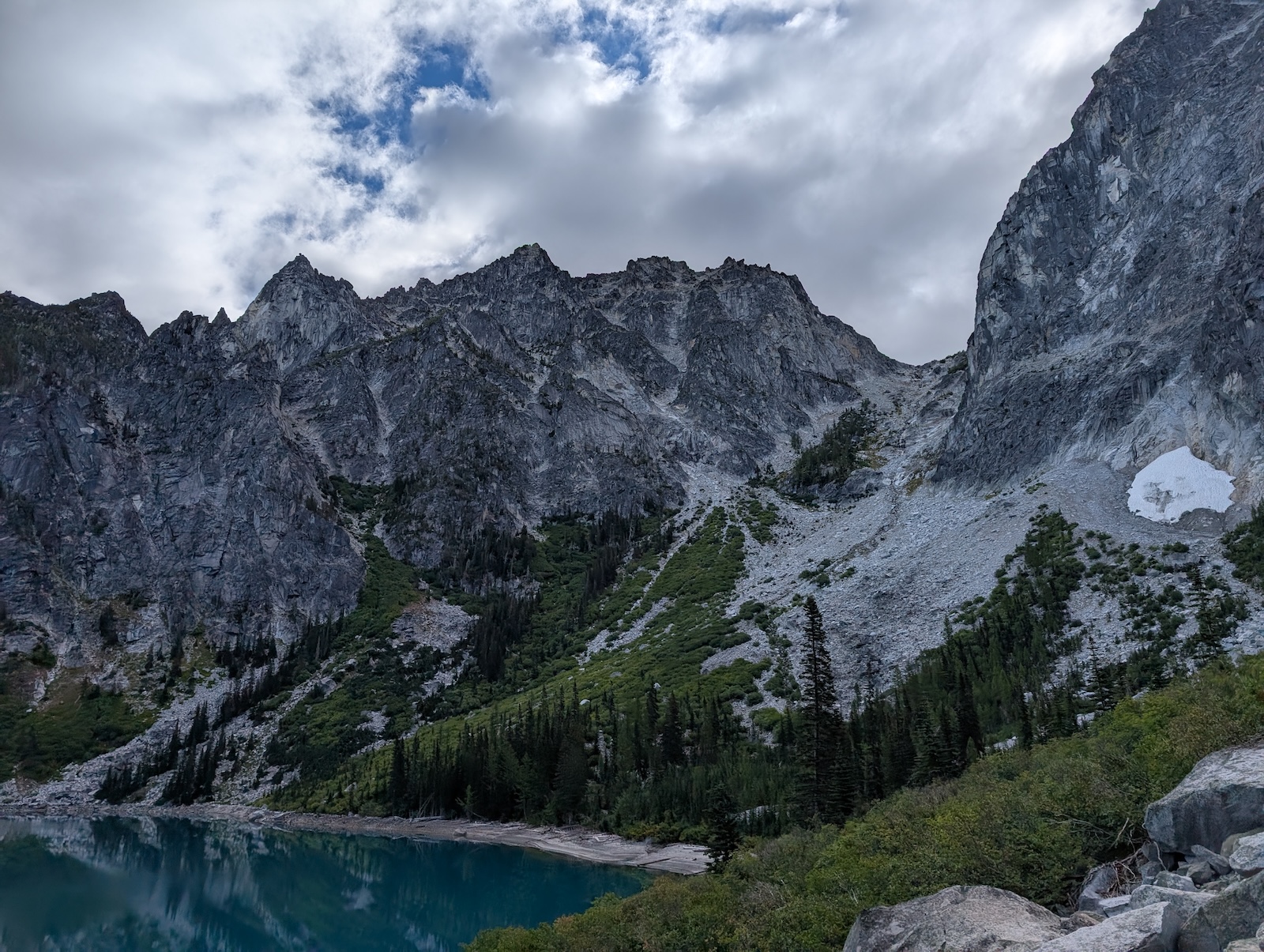
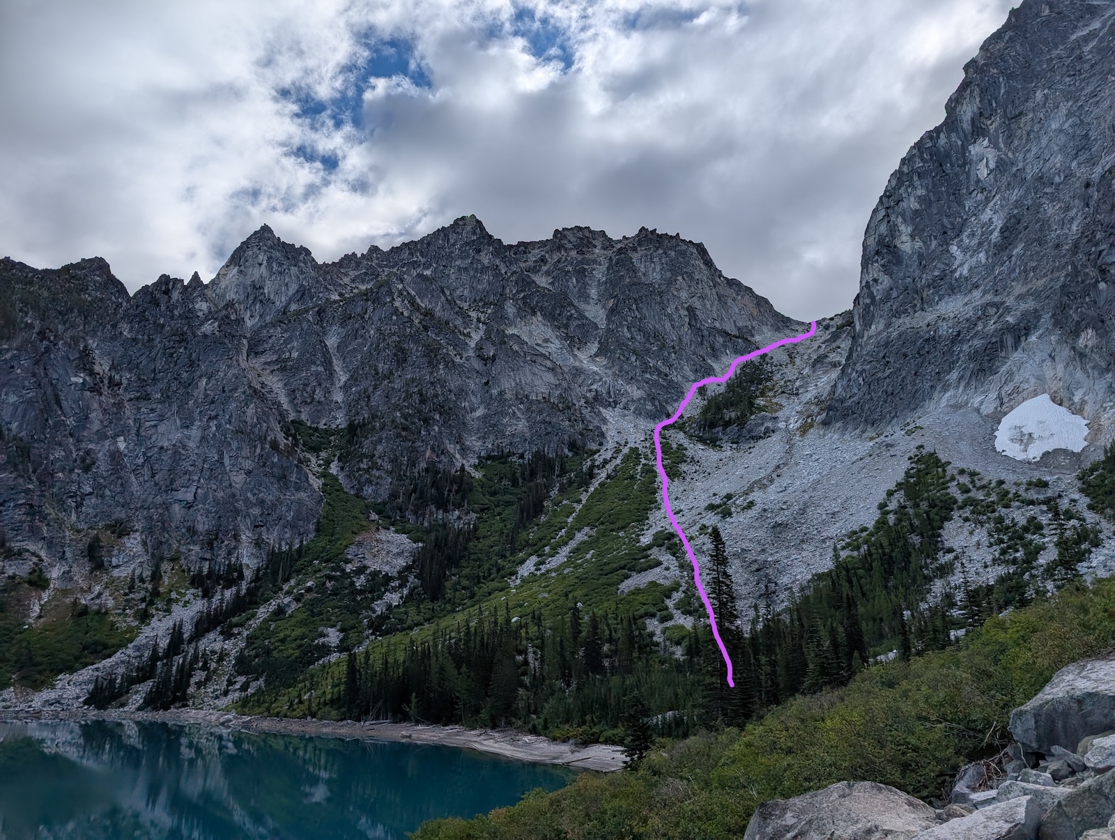
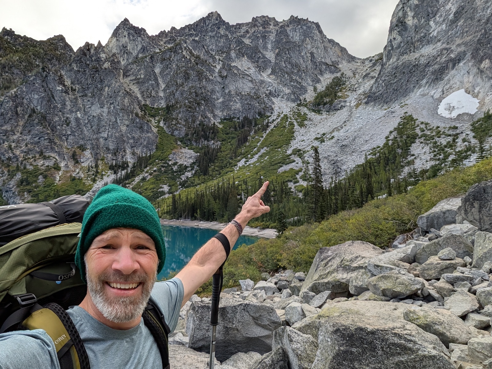
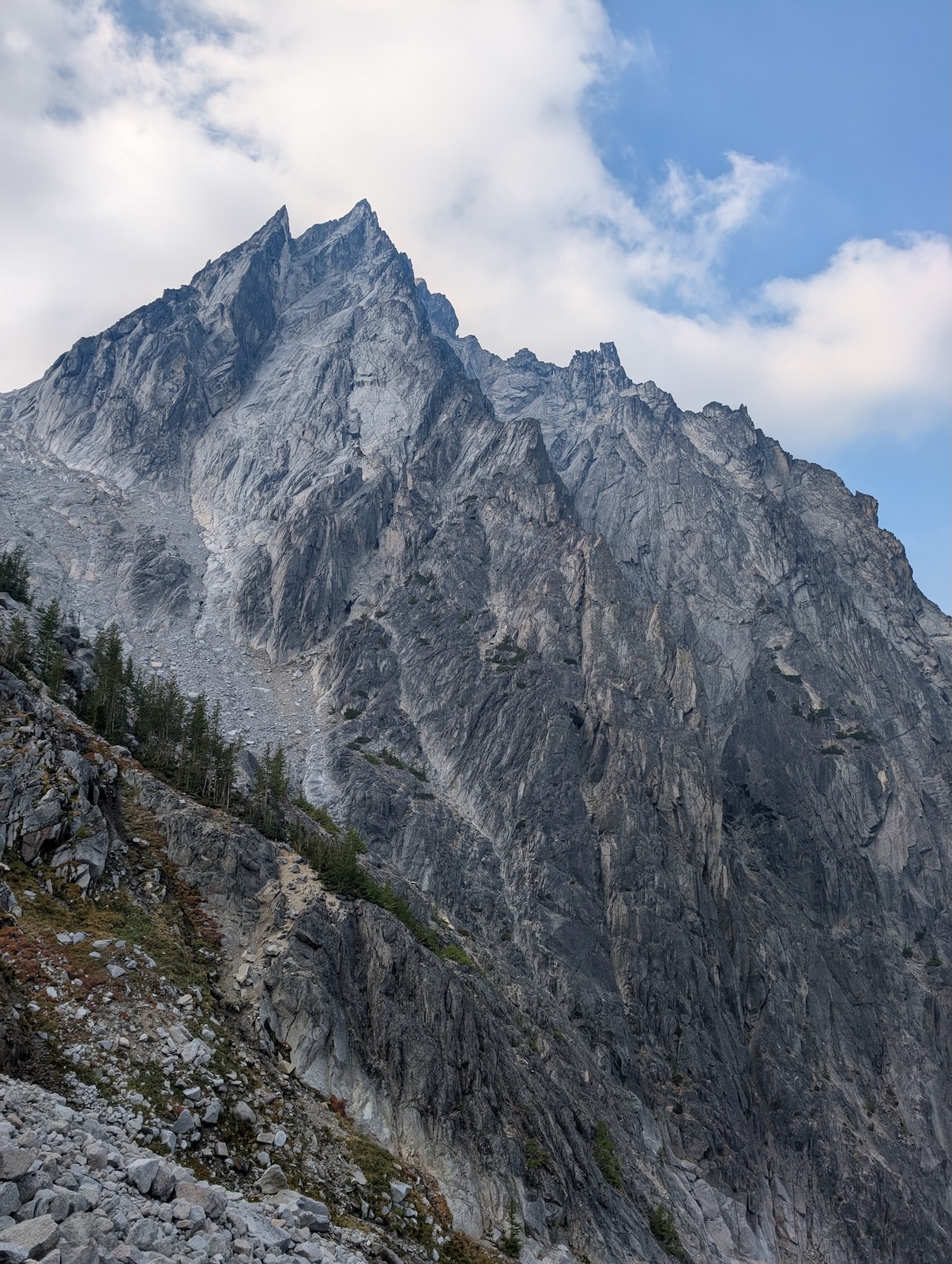
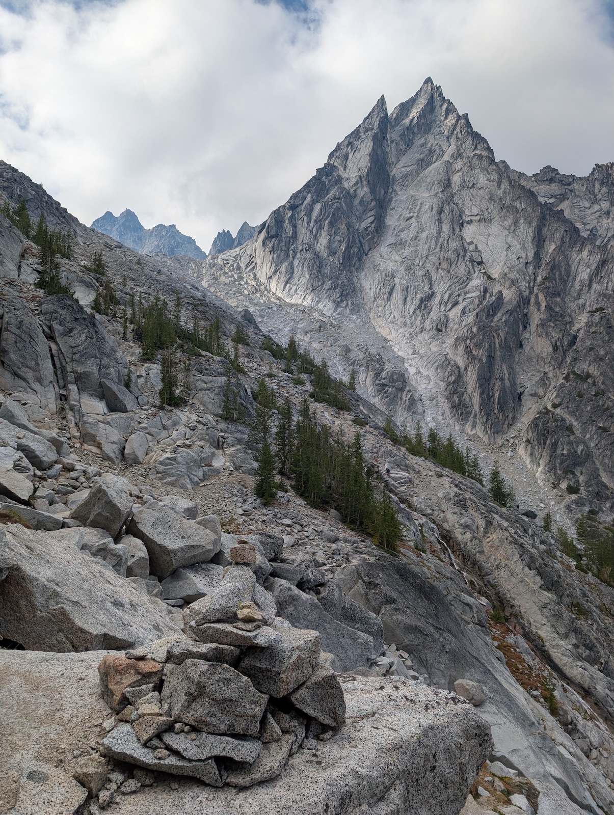
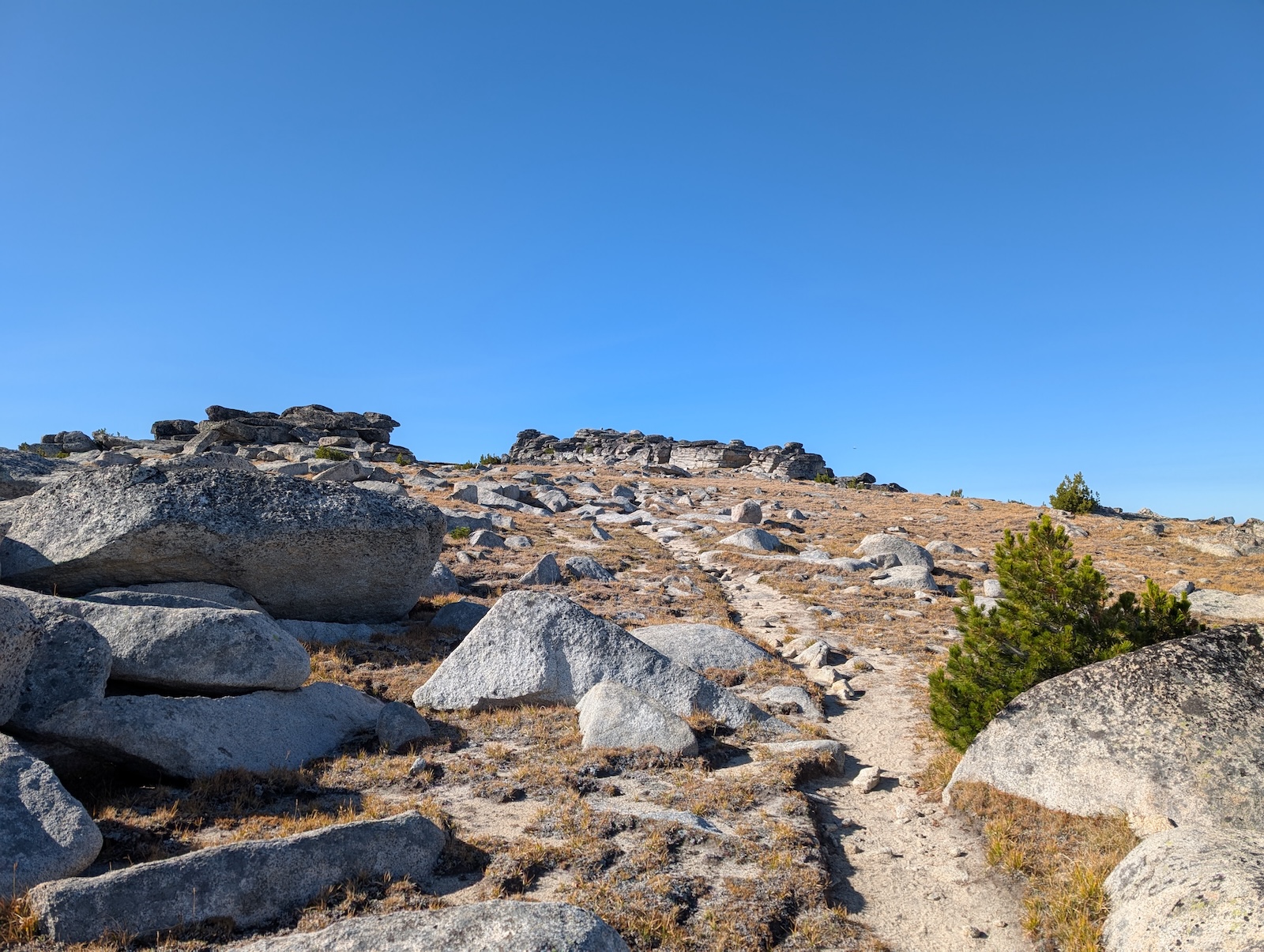
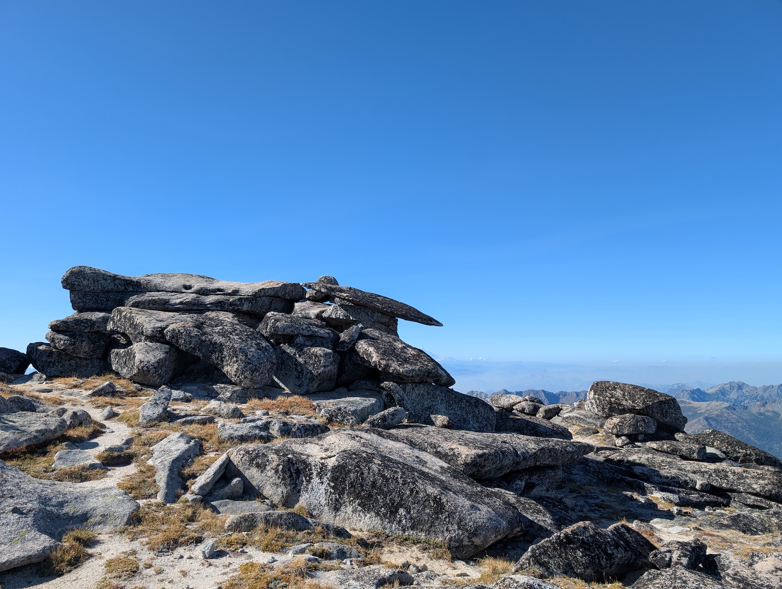
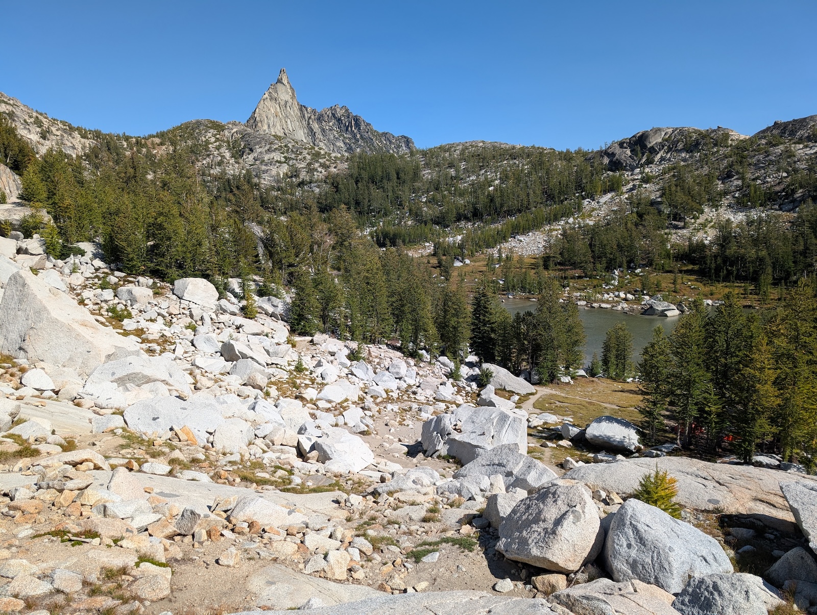
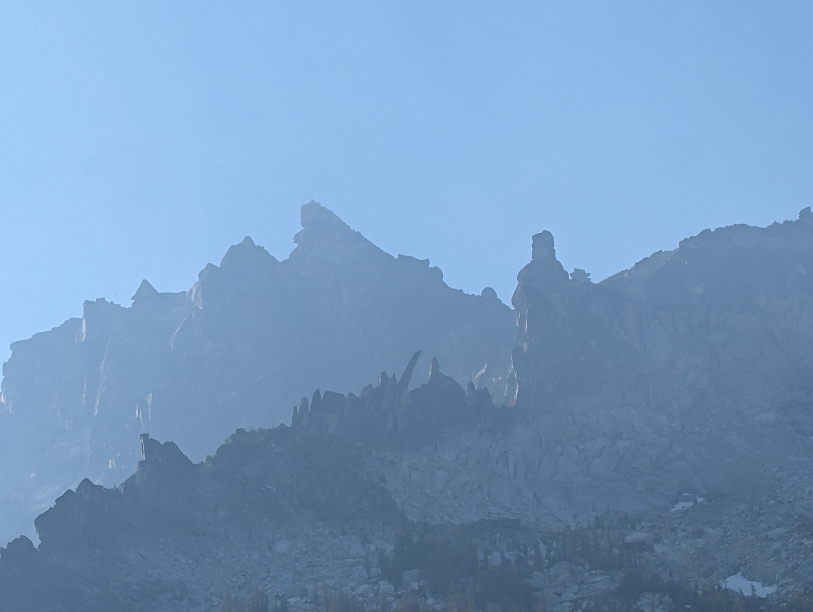
Day 3: Little AnnapurnaIt turned out that quite unintentionally, I had chosen a campsite that was essentially at the branching point for the side trail up to Little Annapurna, so I had readier access to it than anyone else in the park. I headed up it without even eating breakfast, instead packing food to eat at the top. Although it looks imposing from the main trail, Annapurna is actually only a mile long and another 1000 feet of gain. The trail is almost impossible to see. Much of it over pure rock where no wear-down can occur. The only indication of the trail is the series of cairns, which tend to branch and get confusing a bit. As on Asgard Pass, I relied heavily on Gaia to keep me on the official path, which was generally awarded by cairns I hadn't seen from far enough away to actually use them for navigation, but they had been there anyway by the time I reached them, one after the other. Since the official route up Annapurna branches (for no particular reason I could discern) I chose to go up one branch and down the other, just for thoroughness. 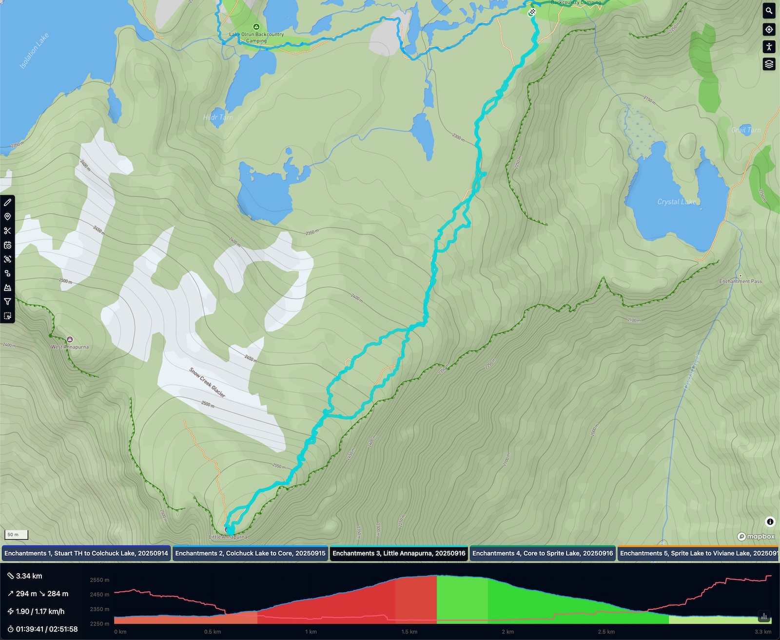
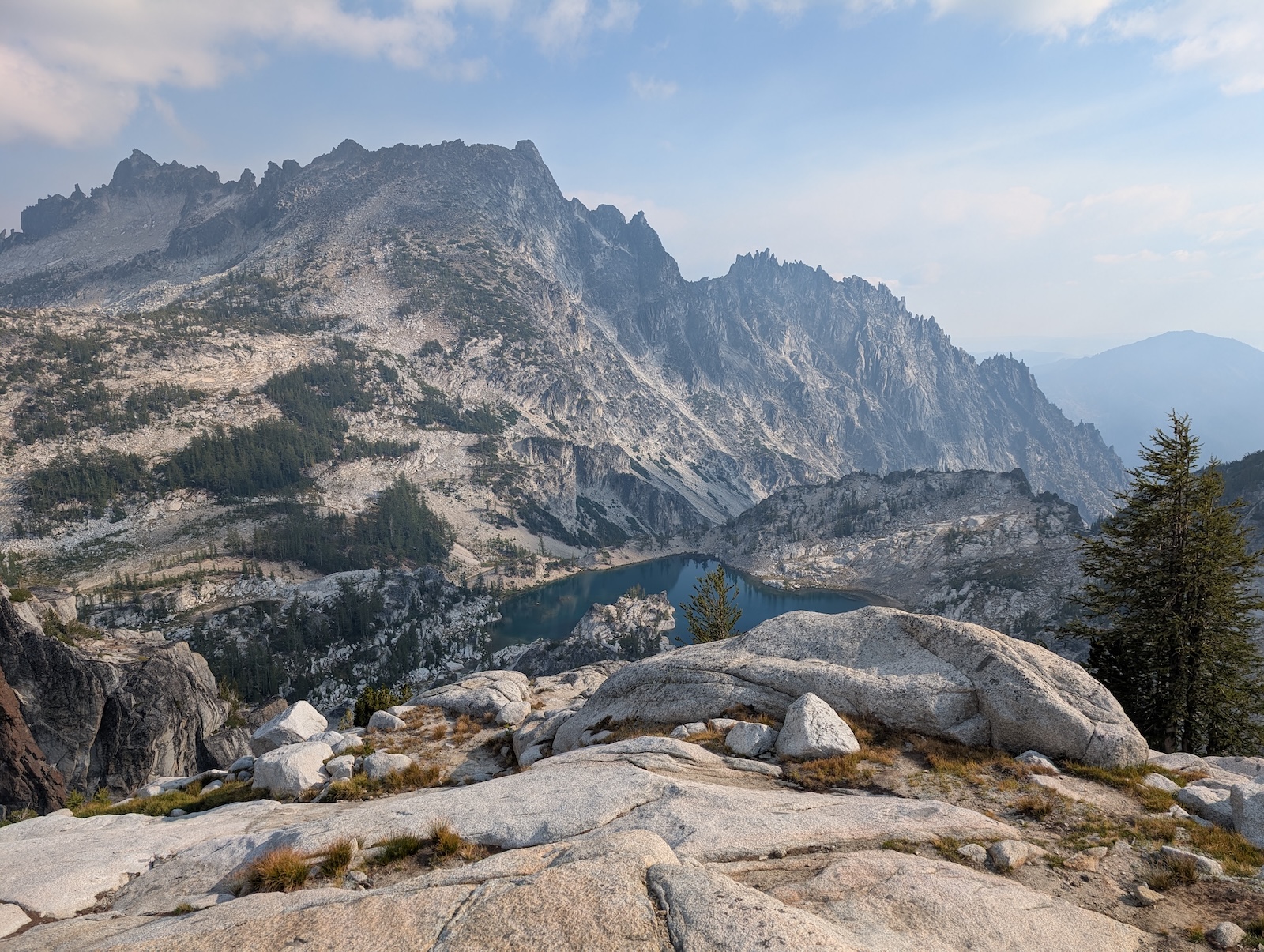
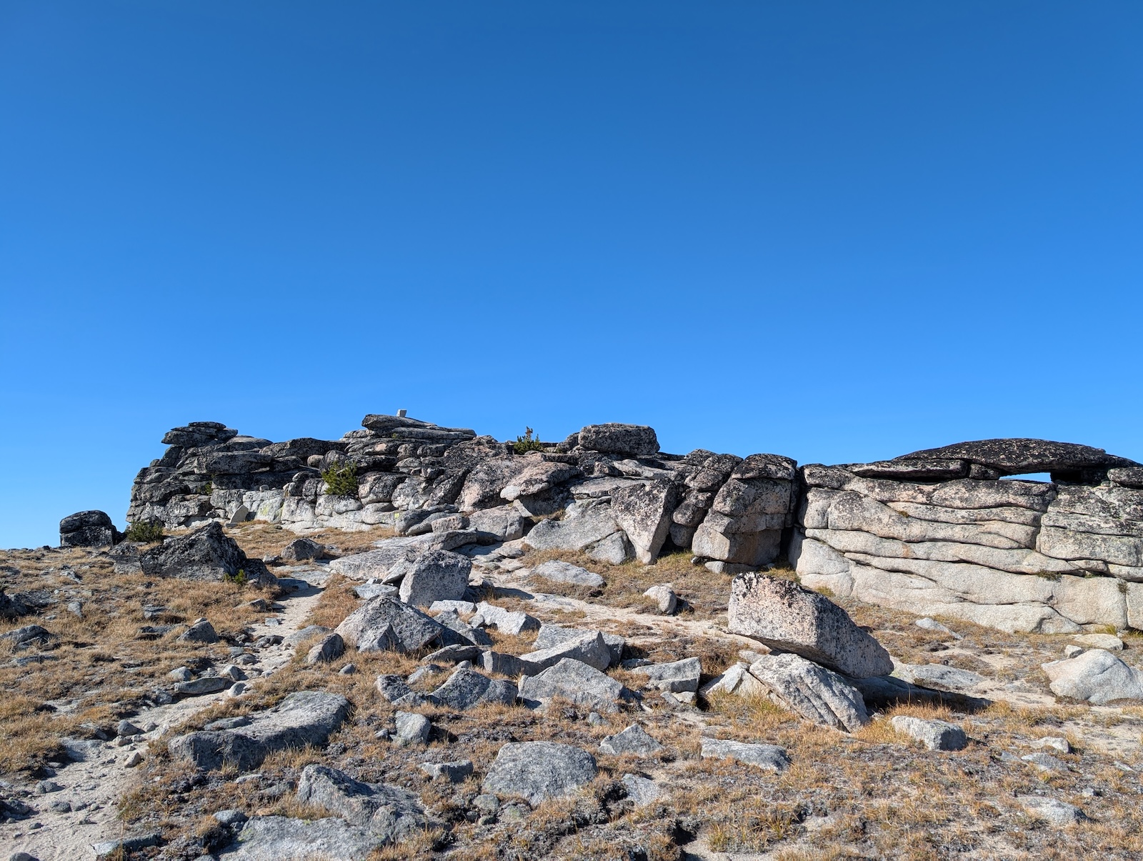
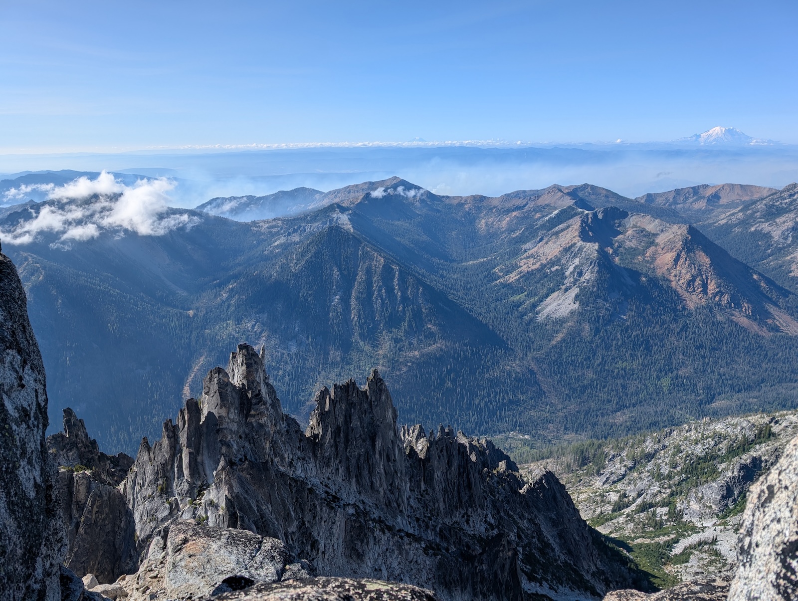
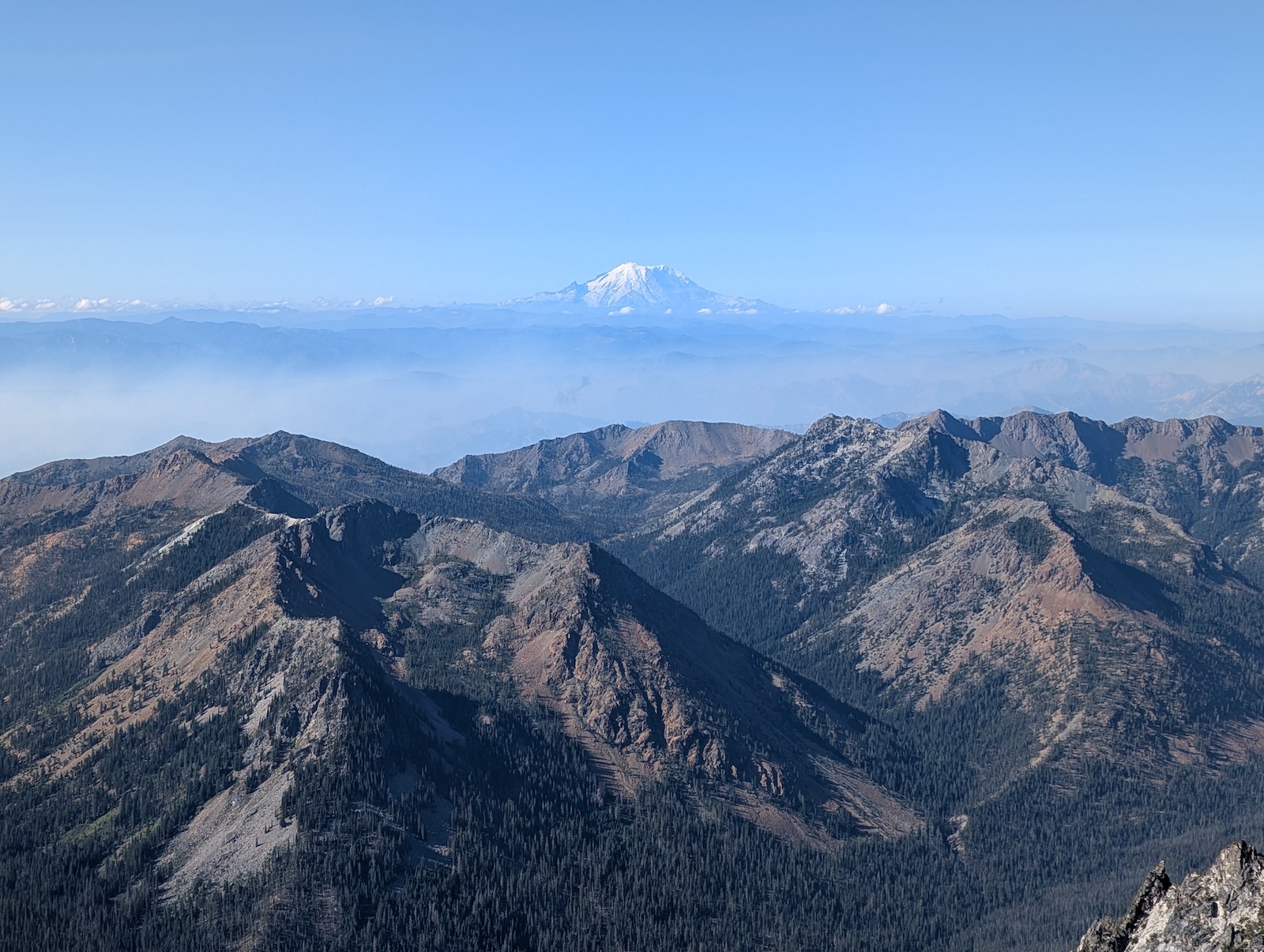
The top of Annapurna is weird. The rock formations up top don't match the rest of the mountain at all. Everything on the top of Annapurna looks like a Flintstones house. Seriously. And the view. Wow! Not only was the sight behind me back into the Enchantments incredible, but the view off the other side, to the south, revealed amazing saw-toothed ridges, endless mountains, and a spectacular view of Mount Rainier. What a great place to eat breakfast instead of back in the campsite (which would have been pretty swell too). 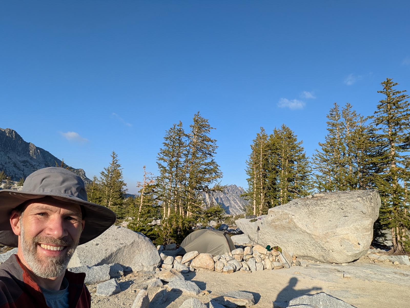
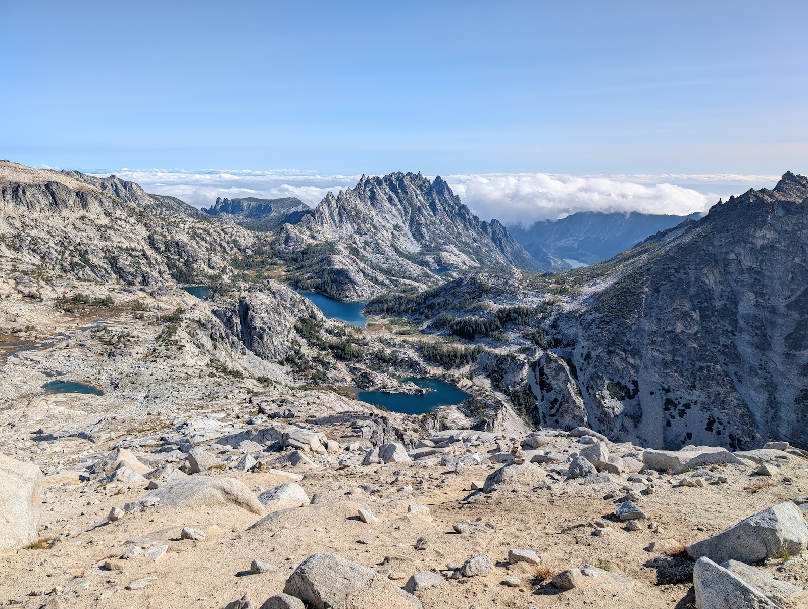
Day 3: From Brisingamen Lakelets past Inspiration Lake and Perfection Lake to Sprite LakeI returned to camp by or before noon, I can't remember, so I had plenty of time to pack up and head farther on down the trail. My original plan had been to do some no-move days, consecutive nights in the same campsite, but it never worked out that way once I was in the thick of it. My schedule always felt like it was ahead of my intentions, without actually trying to rush through the trip. 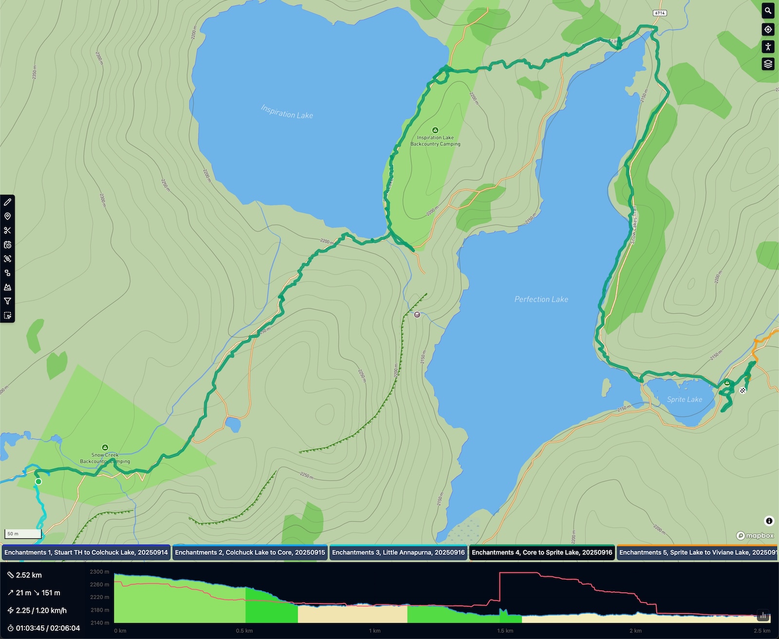
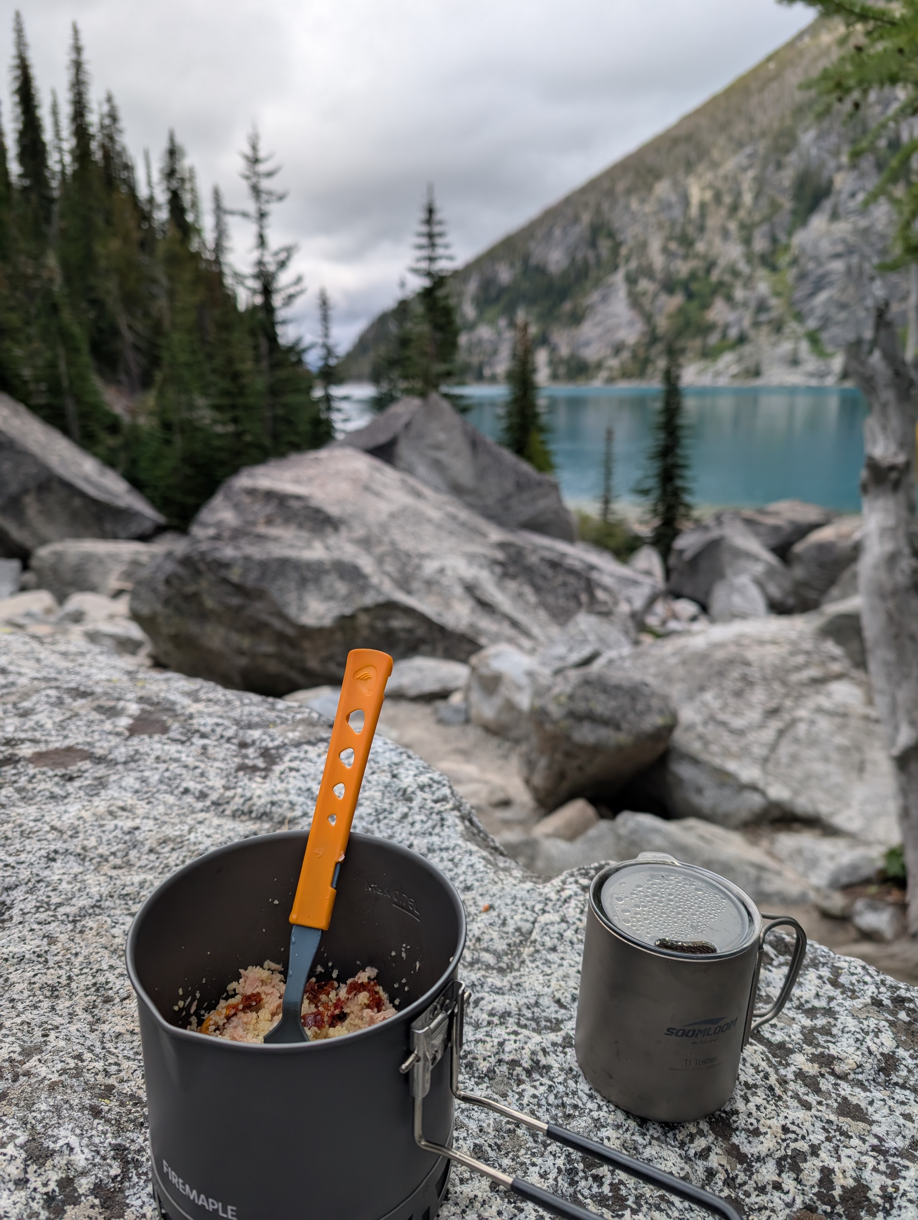
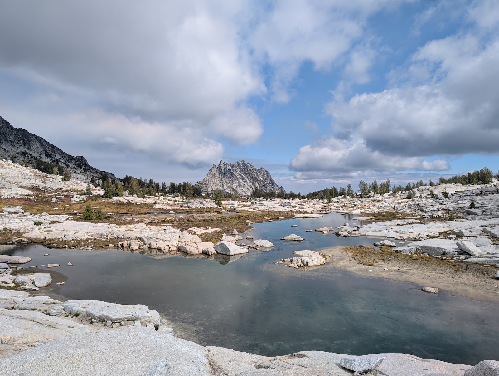
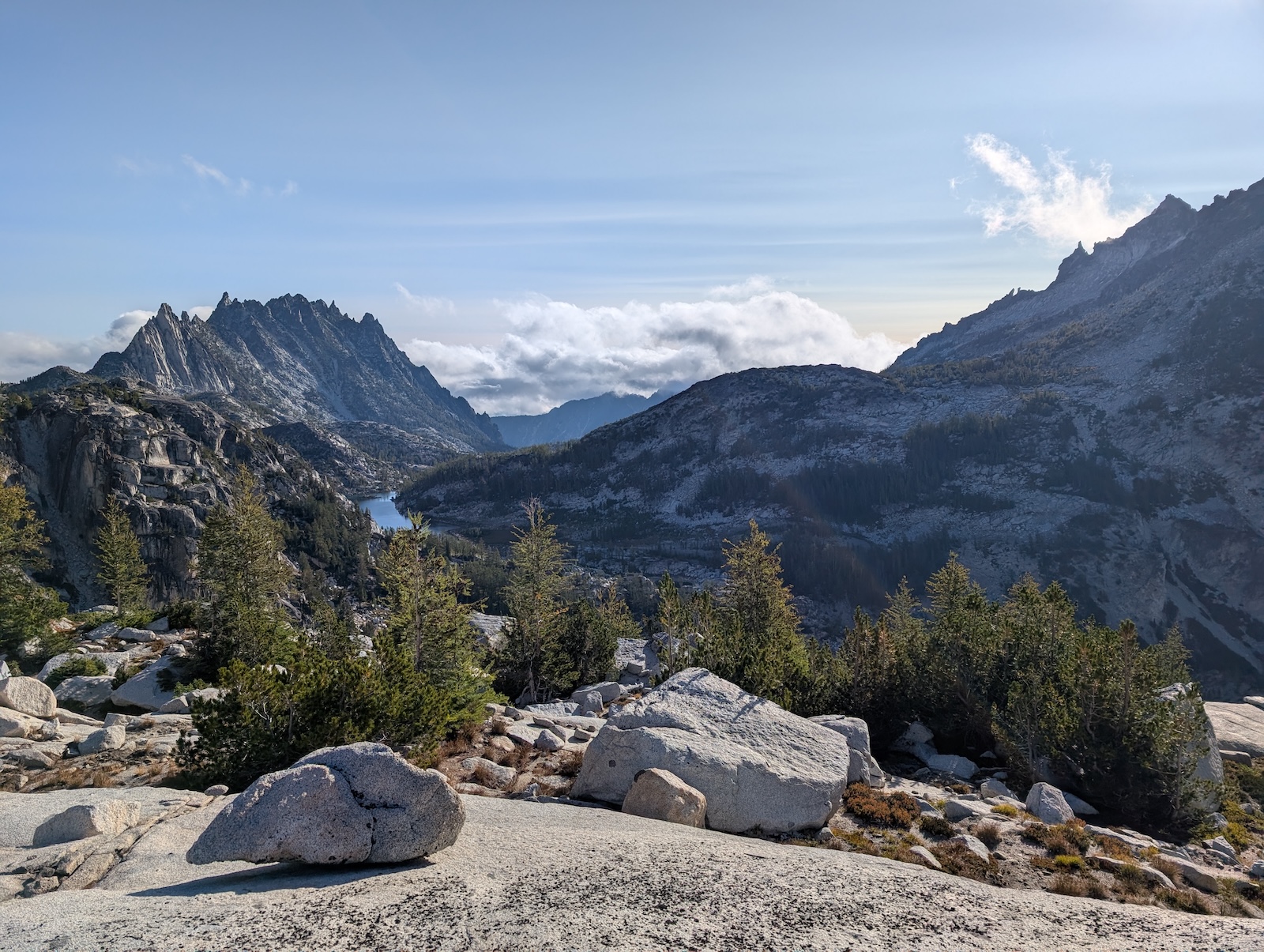
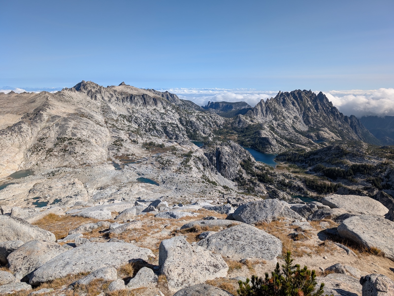
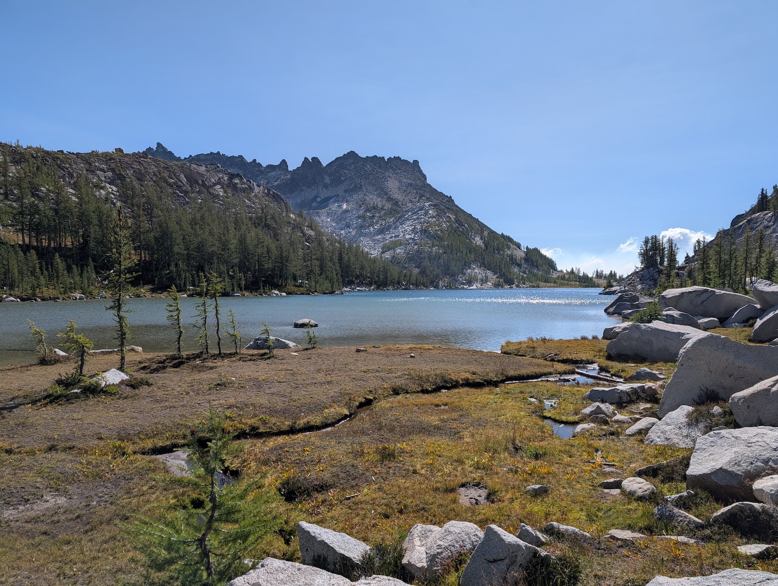
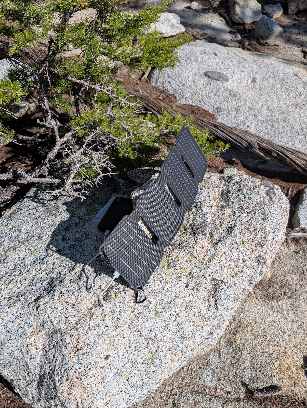
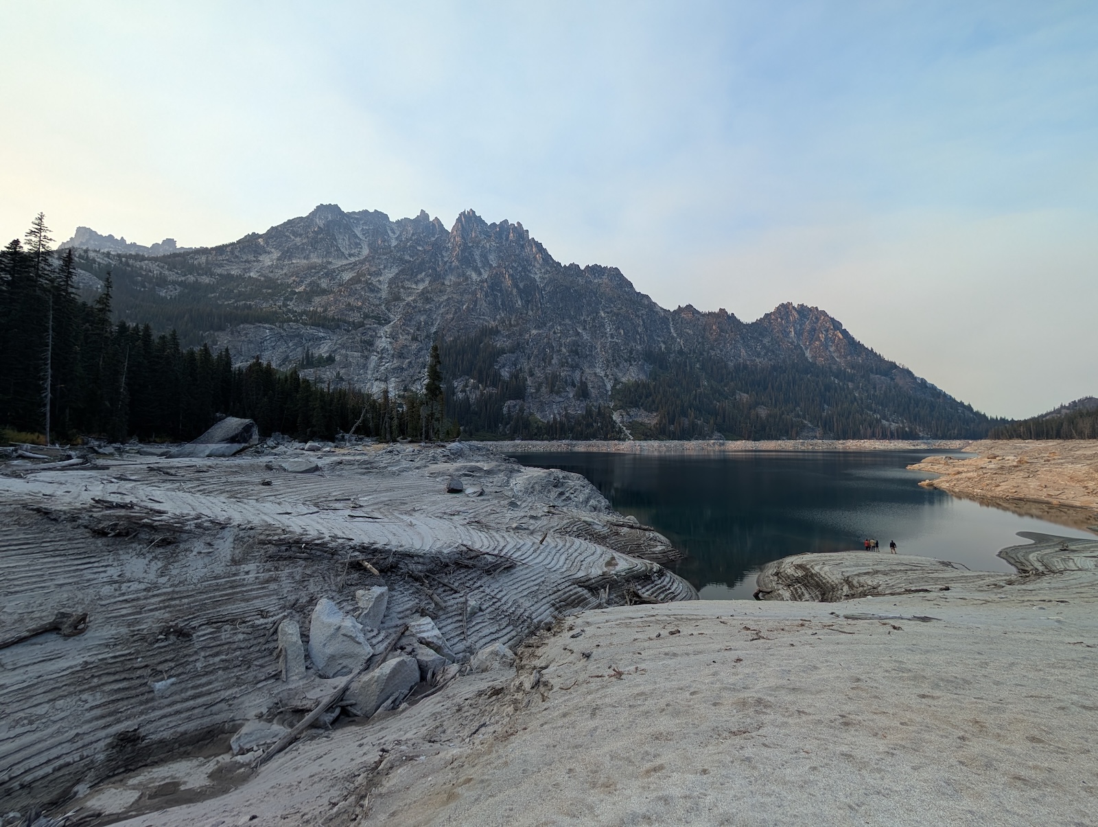
The first landmark was Inspiration Lake, which is tucked between a high, steep ridge on one side, and a smaller hill on the other, thereby hiding it to some extent. It is a wonderful little secret (not really secret, as it is on the main trail). People were definitely swimming there as I approached. I suspect it is used in that fashion a lot. Directly below Inspiration Lake, on the other side of the aforementioned hill, lies Perfection Lake. This was one of the most incredibly places in the Enchantments. Perfection Lake has two distinct sections, north and south. The south section is harder to access (although there is a side trail in that direction that I didn't explore), but the main trail skirts around the north end. The south end is deep blue water, like most of the lakes in the Enchantments, but the north end is just peculiar. The entire north half of the lake is a perfectly (ha!) flat, level, sandy bottom, which at the time of my trip was about twelve inches deep. I was hot, sweaty, and tired. Nothing was going to stop me from dropping the pack, tossing my boots, and wading out into the middle of that freaking lake. It was incredible to stand there in the cool water and turn slowly around 360 degrees, taking in the view all around me. One of my biggest regrets, once I understood the overall trail better in hindsight, is not spending much more time here, like an entire afternoon! Oh well. At the north end of Perfection Lake, there is a side trail up Prusik Pass, which is a popular side hike. I didn't fit it into my trip, but it would make a good diversion I think. It is quite popular, I believe. Ultimately, I made my way around Perfection and on to a very small lake directly adjacent, Sprite Lake, where I settled for the night. I had a long lazy evening at Sprite Lake, which gave me time to test out my solar charger as the sun descended, which worked well (it worked even better the next day at Lake Viviane, where I set up under the midday sun). 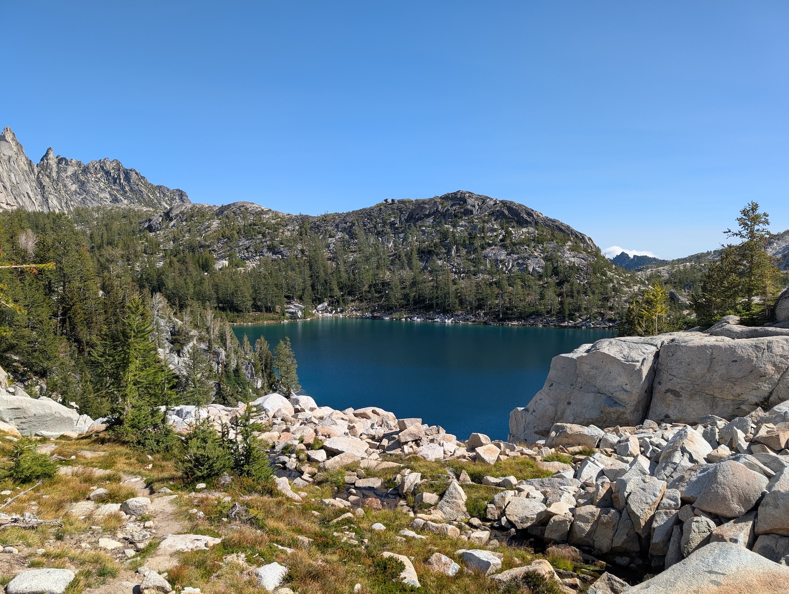
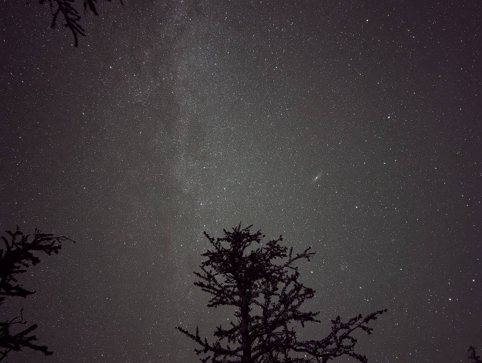
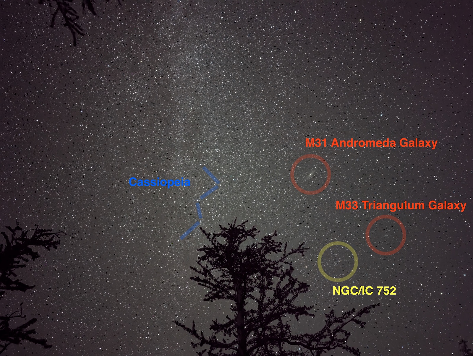
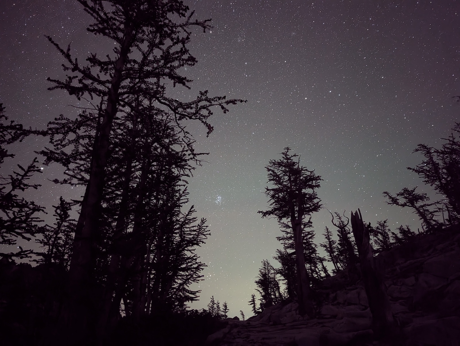
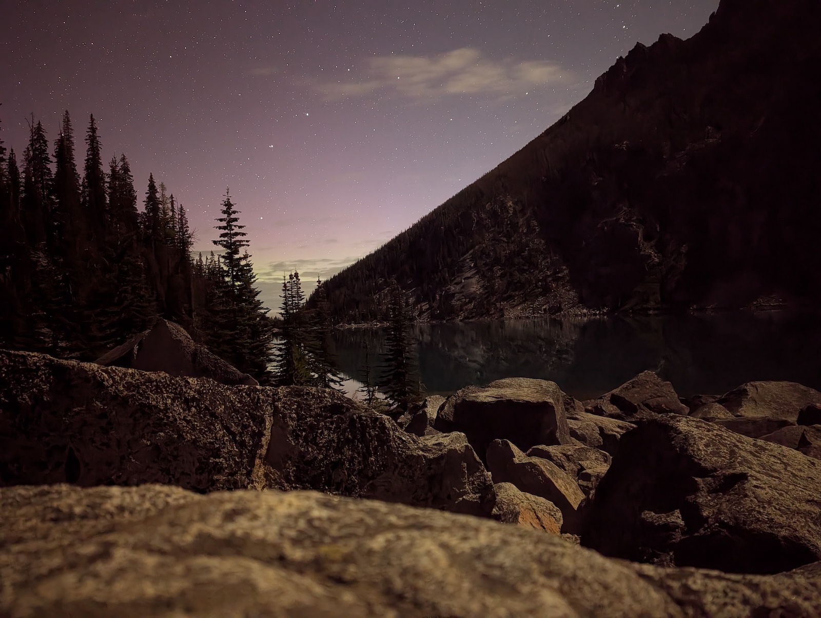
Day 4: From Sprite Lake past Leprechaun Lake to Lake VivianeAs with my second night, my third night, at Sprite Lake, was in utter isolation. As before, people passed along the main trail for throughout the afternoon after I set up camp, but no one else stayed in the area, which meant that I once again had no one anywhere near me for the night. Pure bliss. I got some great astrophotos of the Milky Way, the Andromeda Galaxy, and the Pleiades too. 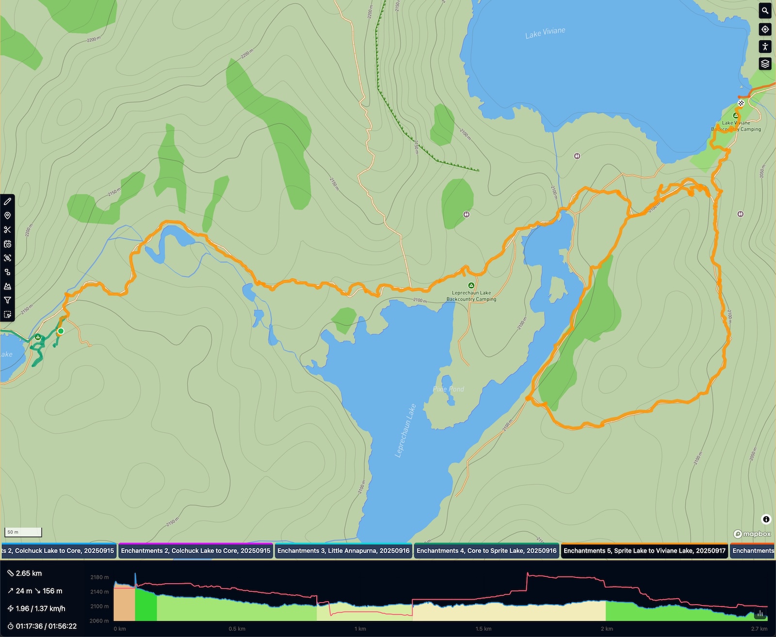
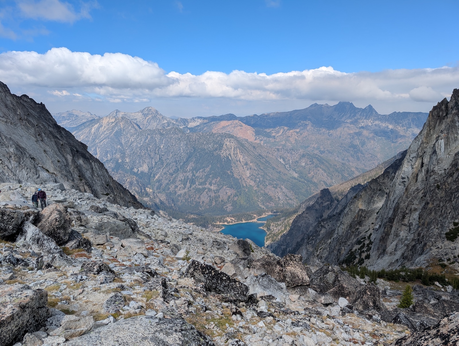
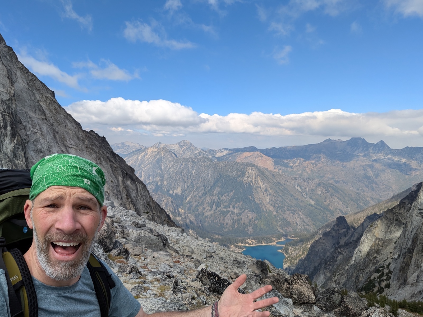
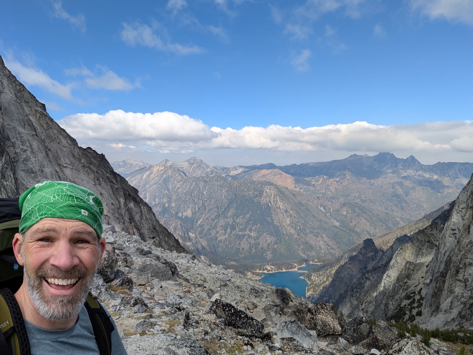
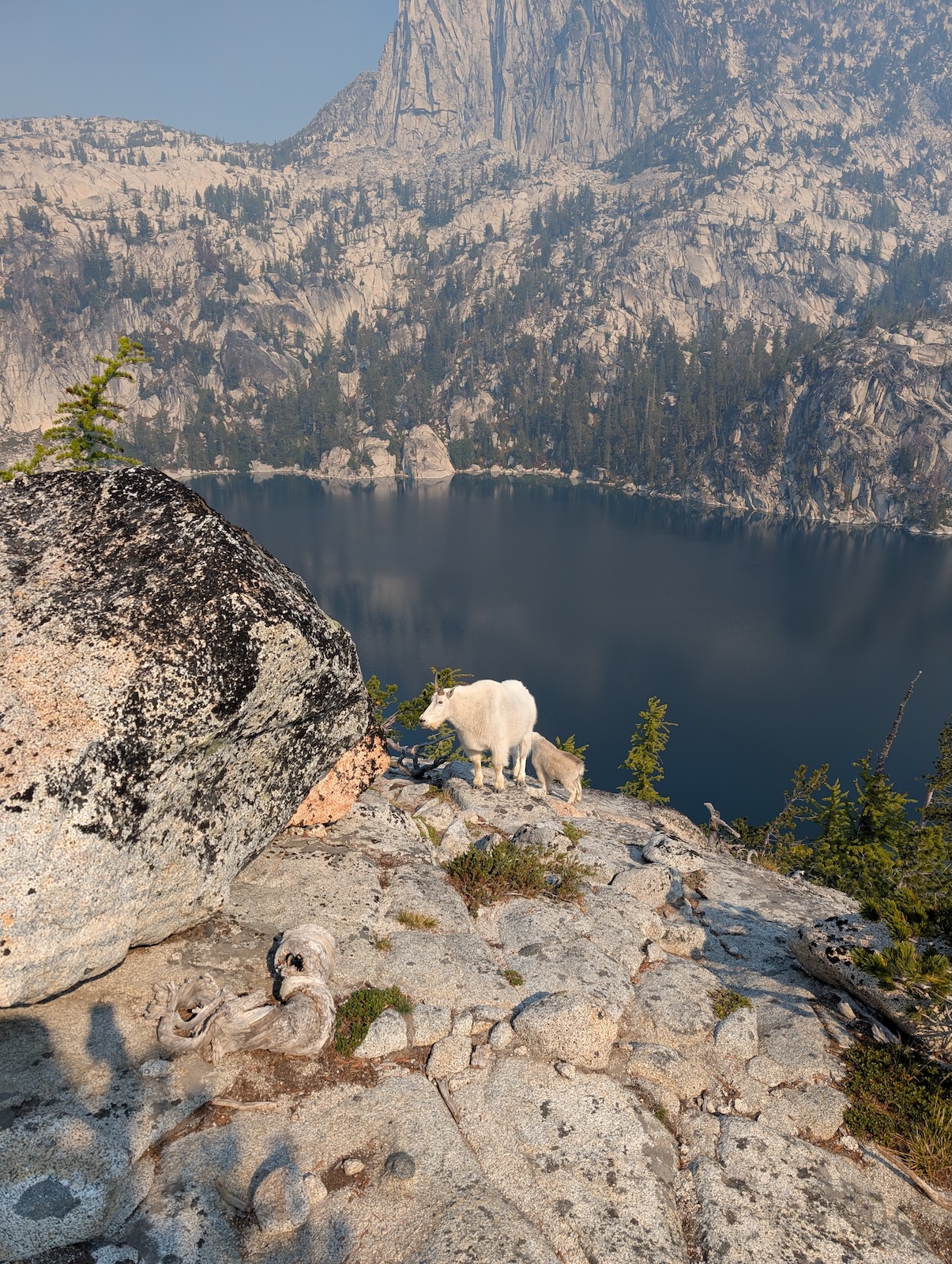
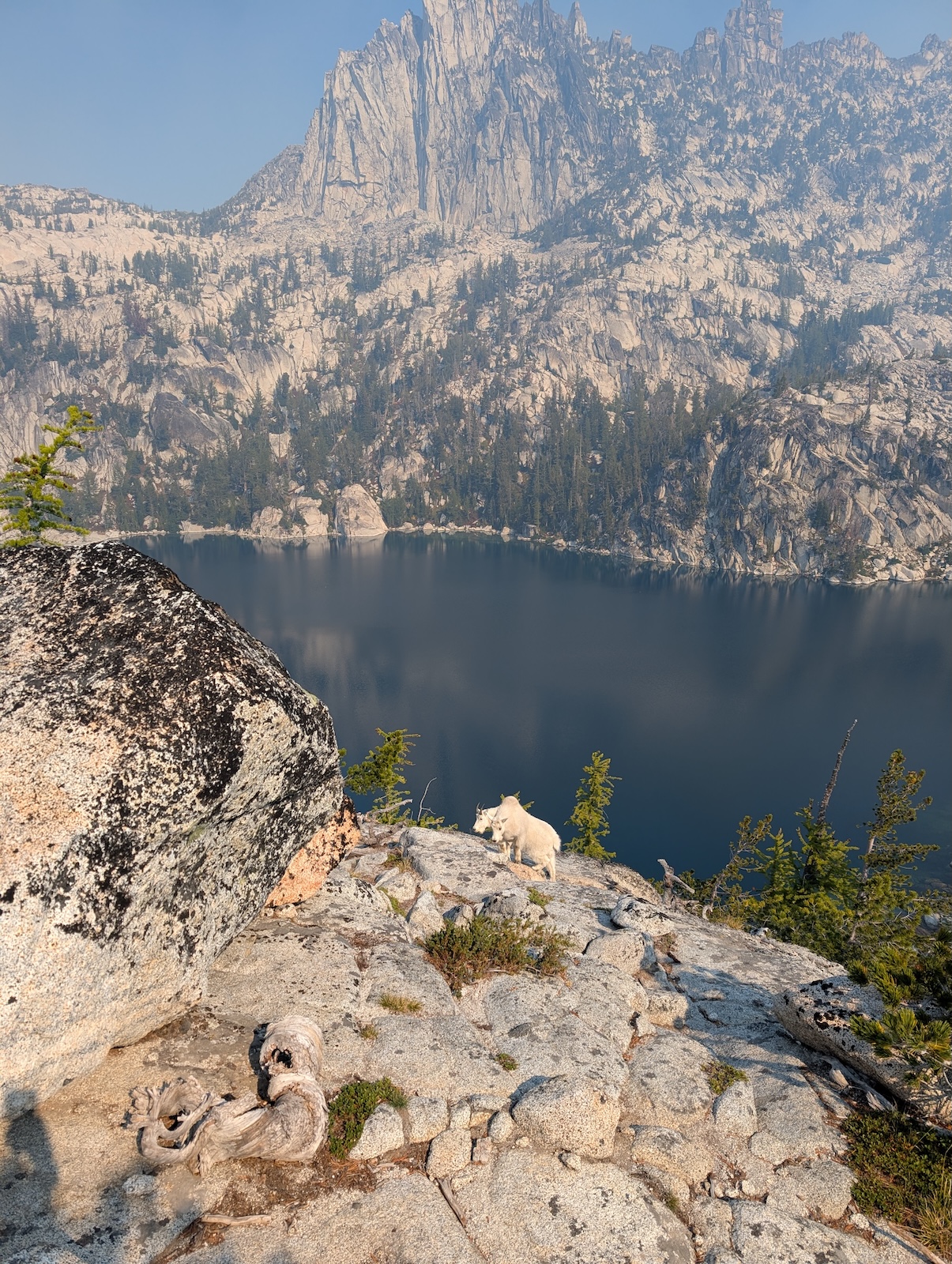
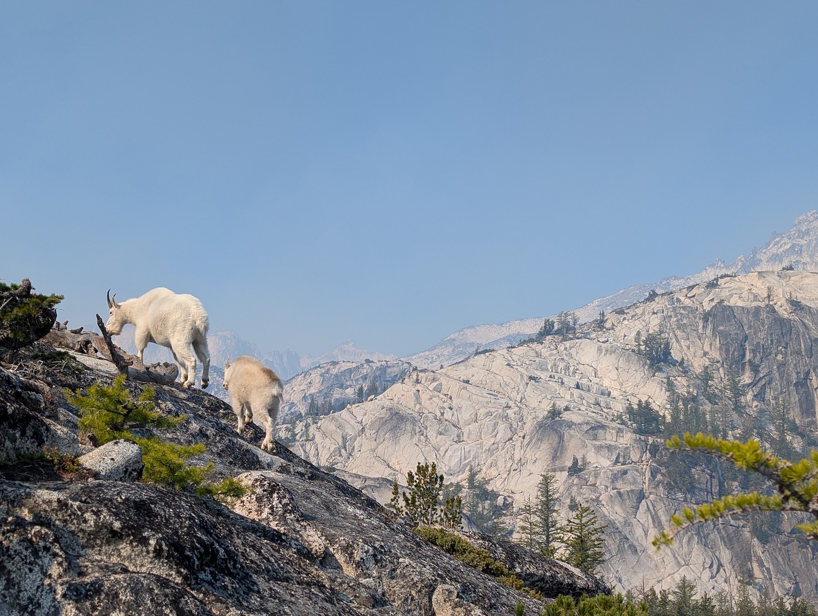
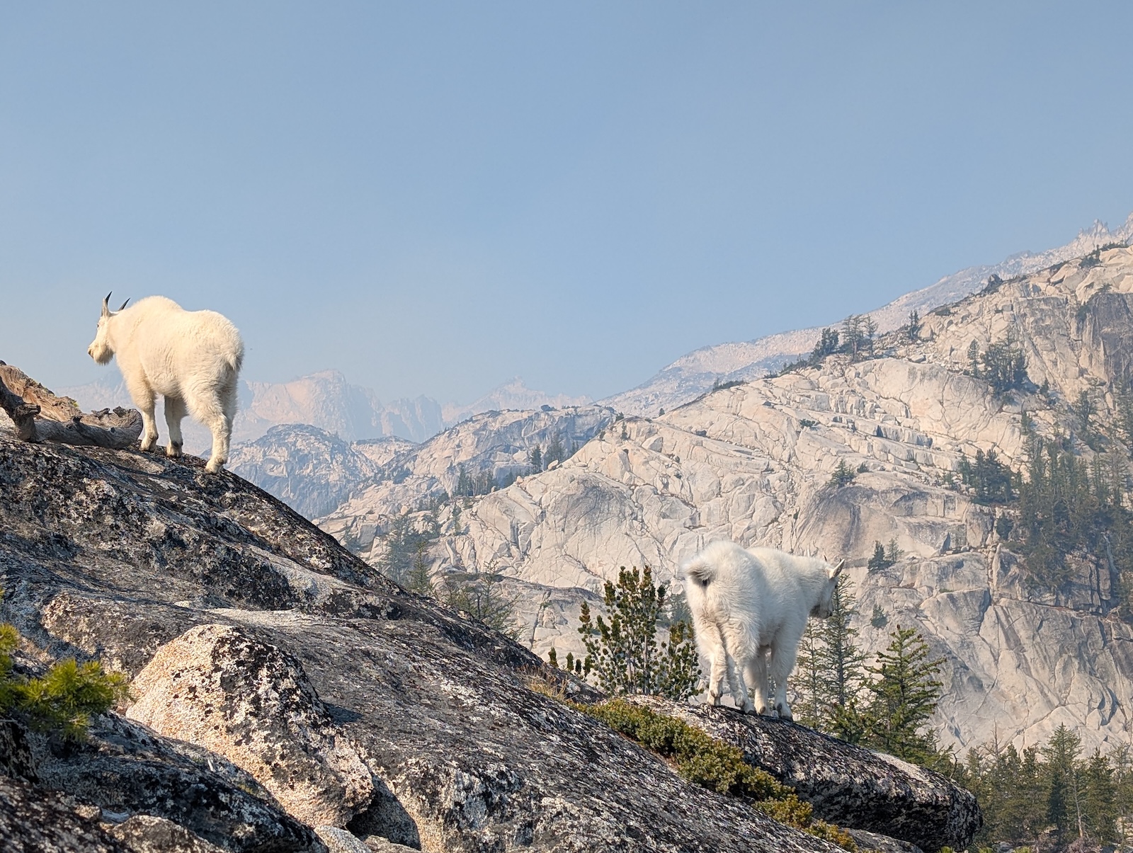
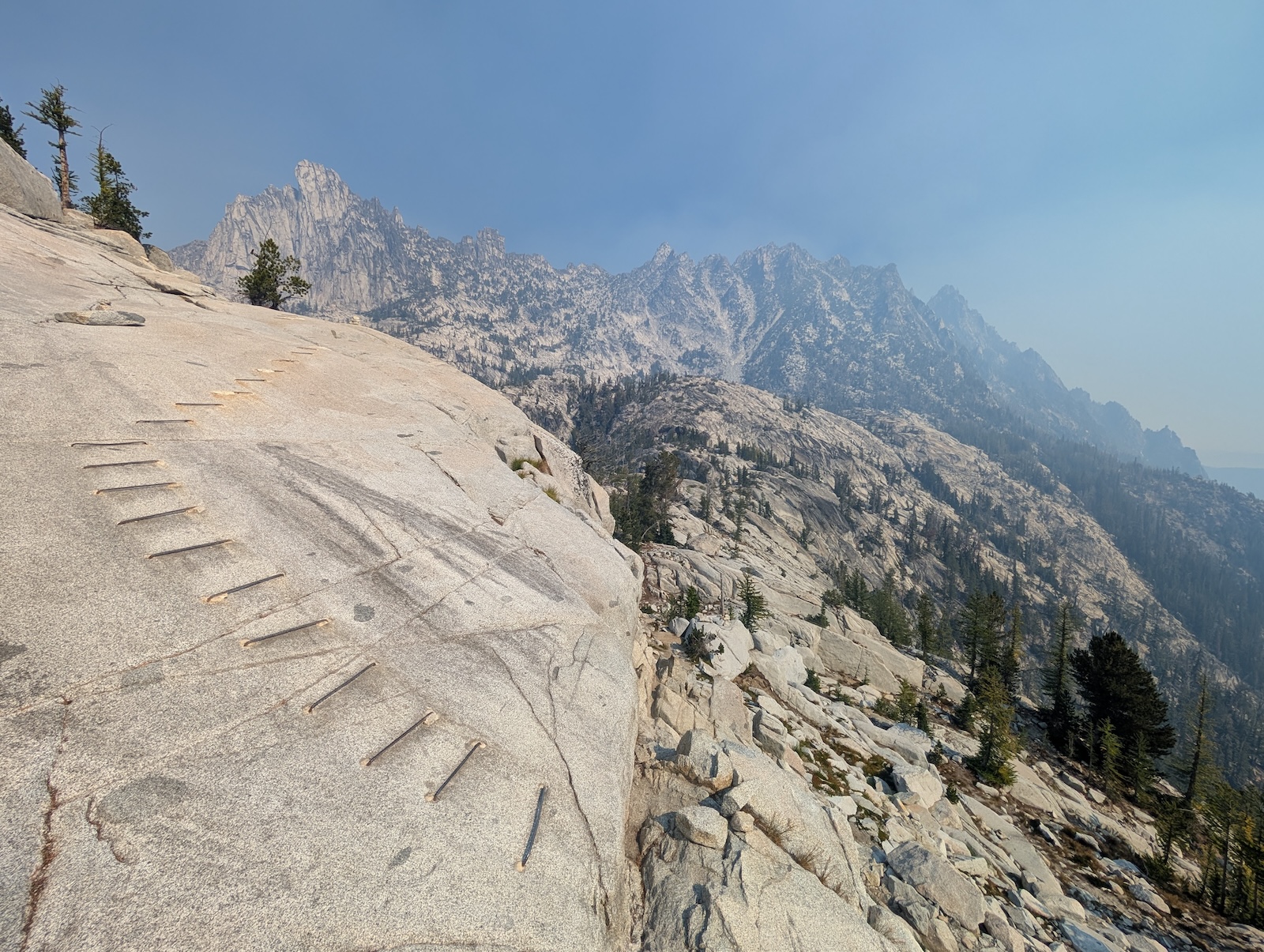
As I awoke at Sprite Lake, I stuck my head out of the tent and couldn't believe the sunrise watermelon mountainside I saw. I got the timing just right on that one. After packing up, I headed onward, past Leprechaun Lake and on to Lake Viviane. This area was, frankly, confusing. Leprechaun is fairly uninspiring, and while Viviane looks very nice as you approach it, it is actually very difficult to reach along the official trail. This is by far the worst section of the trail. You have clamour up over and around a steep pinnacle, where the trail seems to get a bit lost, and on the other side, you arrive at a really sketchy rounded off steep rock that is so untraversable that they embedded rebar in the rock to assist with traction. I am going to be blunt. While thousands of people make it through that thirty-foot section of the trail every year, it is built such that if it works, everything works, but if you fall, you will most definitely slide all the way off that round rock, and over the edge to the base below it, at least twenty feet, where you will collide with jagged ridges below. It isn't a thousand foot drop-off, but you don't want to fall off it, that's for sure. Yes, it is traversed successfully all the time, but if you were to lose your footing, I don't believe you would regain it. It was on this same pinnacle of rock next to Lake Viviane that I had my only mountain goat encounter, but it was a doozy. First I saw a large adult come over a ridge straight toward me with no hint of fear. Then I saw an obvious adolescent behind him, and then a second one. Eventually I saw a second adult as well. The first one came straight at me though, and once I knew he had kids with him, I was kinda nervous as to his intent, but I gave him a holler and he led the family off to the side where I could get some good photos of them. As it turns out, by backtracking a short distance, there is an obvious alternative route, not the official main trail, that takes you on a very pretty tour of Leprechaun Lake and comes around to the base of that rough section. So, I did that instead. In my opinion, that should be the main trail, but I suppose it would add length, which would make things harder for the hurried thru-hikers. It is what it is. I got another quiet section to myself that almost no one else explores, so I think I won out in the end. 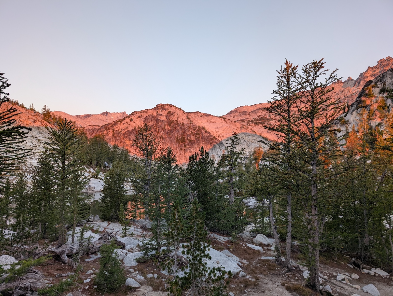
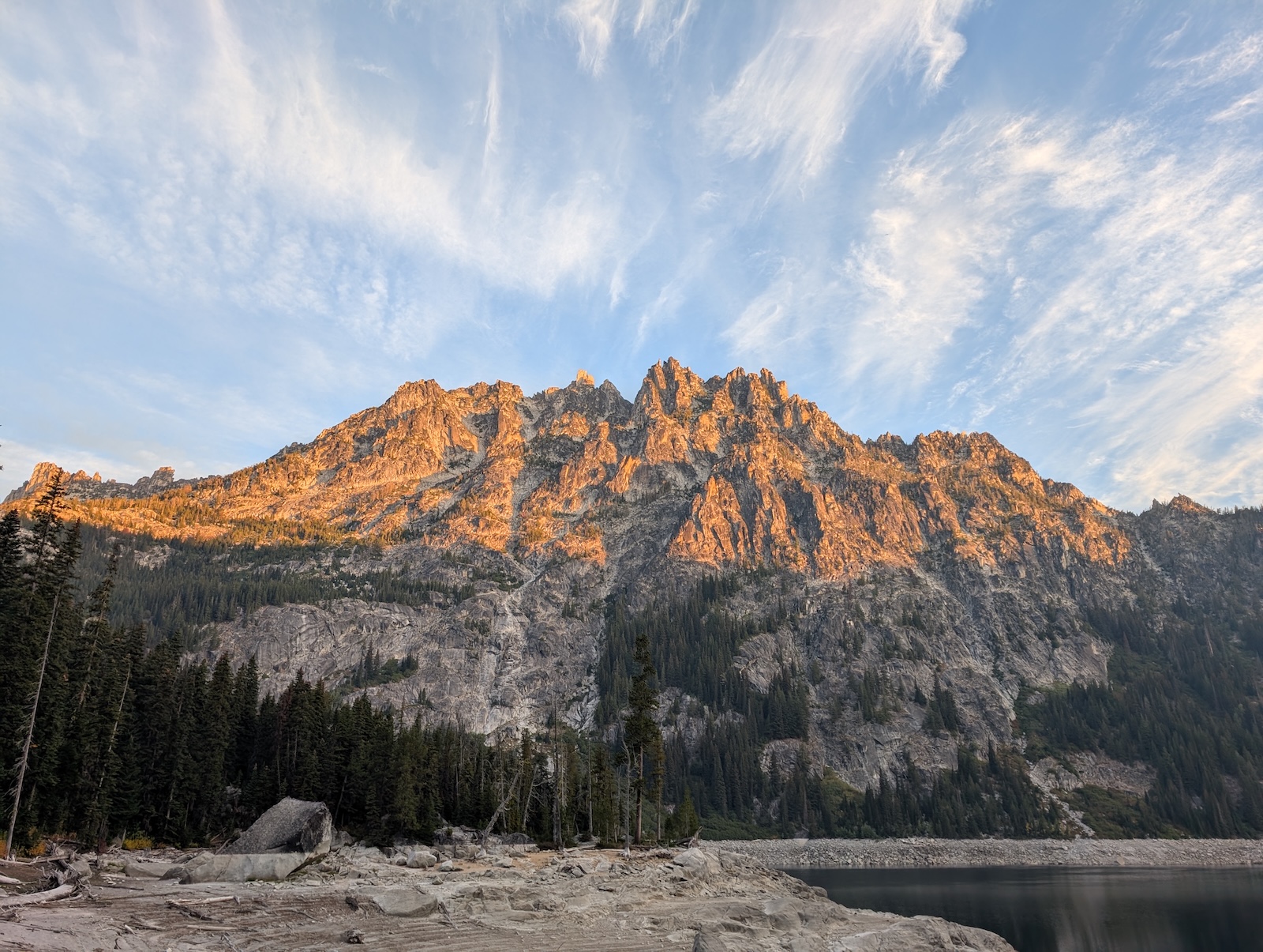
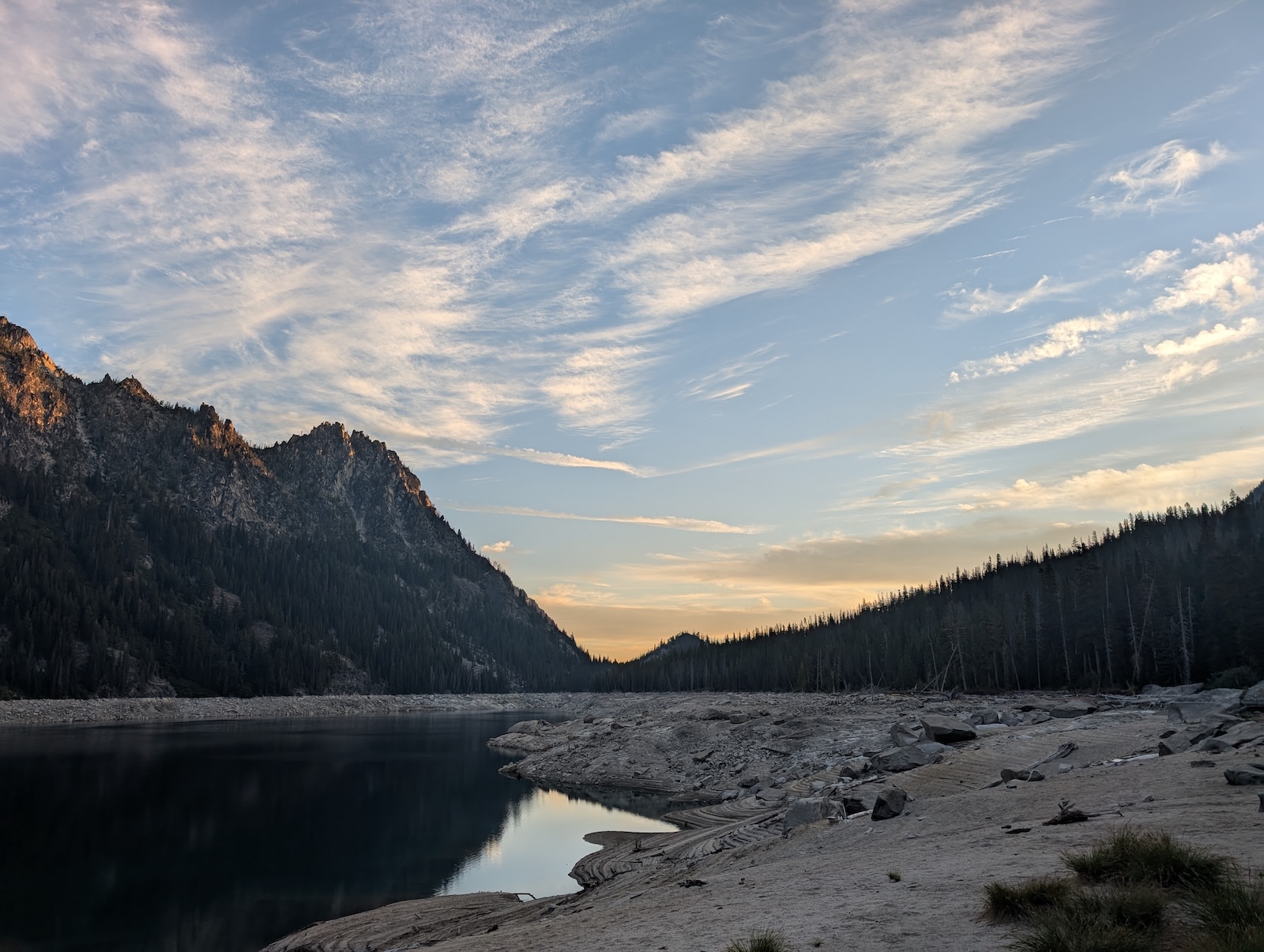
Day 4: From Lake Viviane to Upper Snow LakeThe next stop was Lake Viviane. There is camping here and I believe it would be a very pleasant place for it. For my part, I took a long rest here. I waded into the cold water up to my thighs and splashed water on my face, but chickened out of a full plunge. While I did this I let my solar charger reload the powerbank as well. I then headed onward to Snow Lake in search of the night's accommodations. The descent to Snow Lake is quite steep incidentally. Not Asgard Pass steep, but it takes a while to be sure. After I had already passed the Snow Lake inlet and wandered pretty far in search of a site apppriate for my tiny tent, I came to the conclusion that I wouldn't find more water and wished I had refilled at the inlet. I turned around and headed back, with my full pack in tow. After settling for a site, I then continued all the way back to the inlet, carrying just the water bottles and then returned to the campsite. 
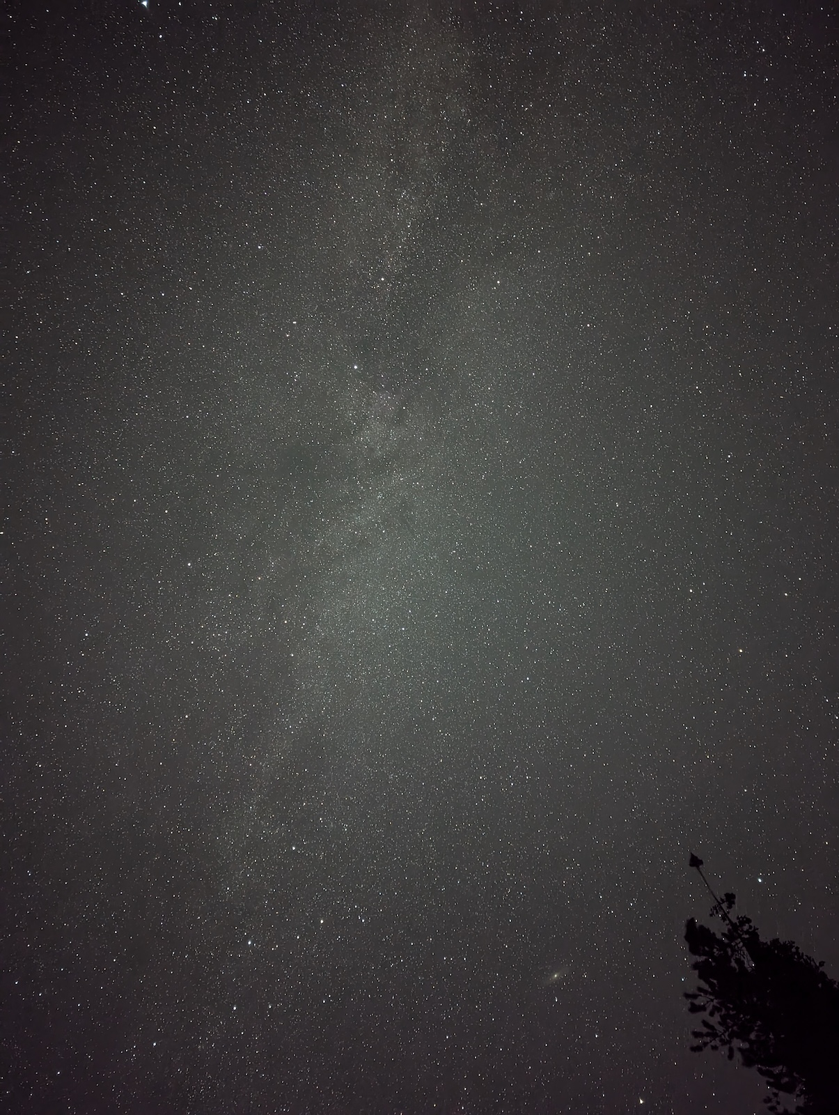
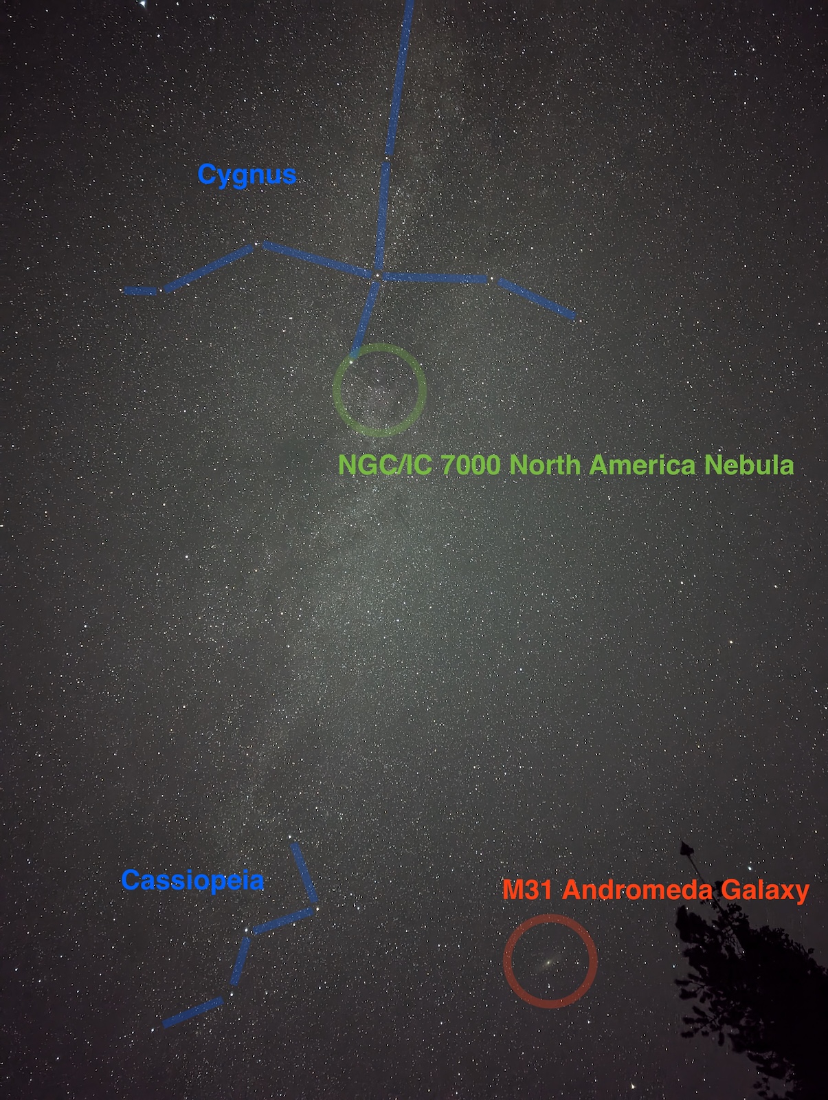
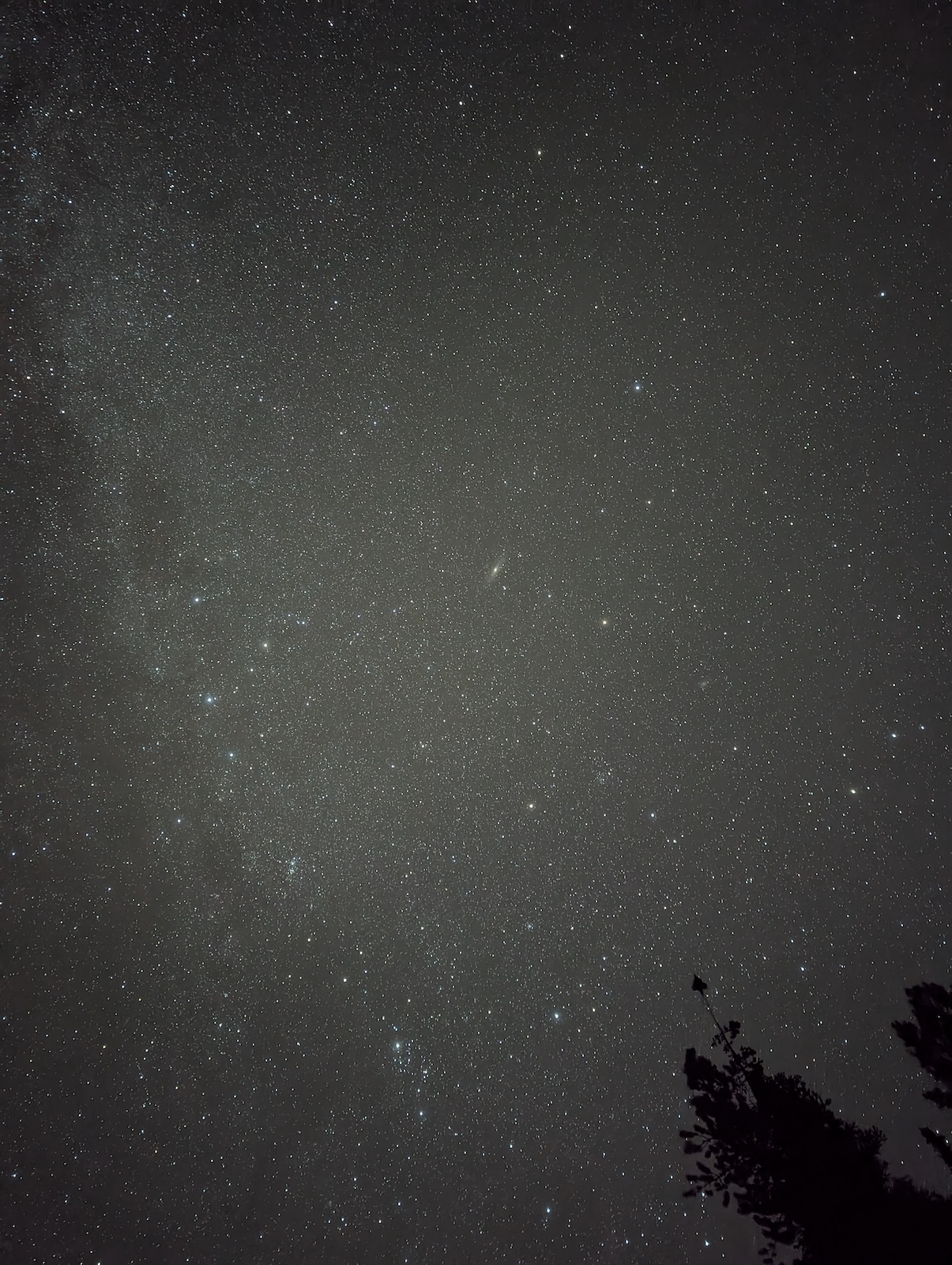
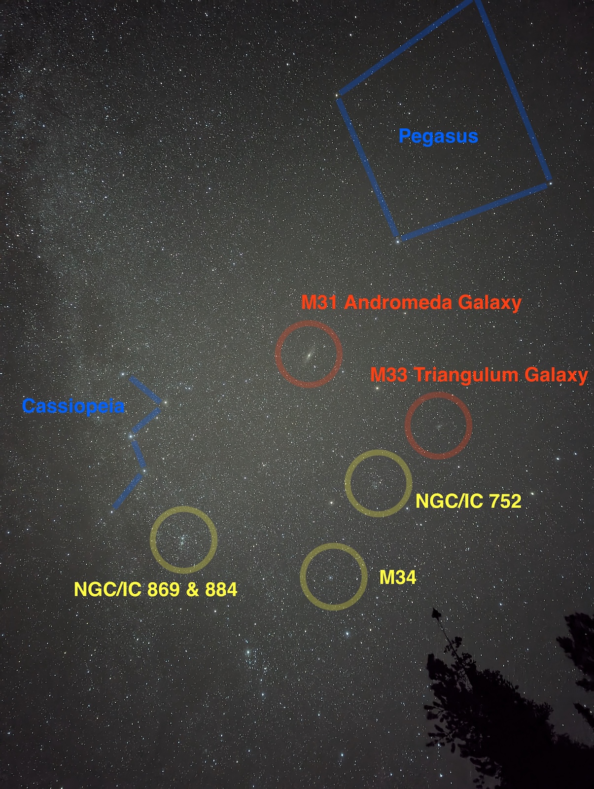
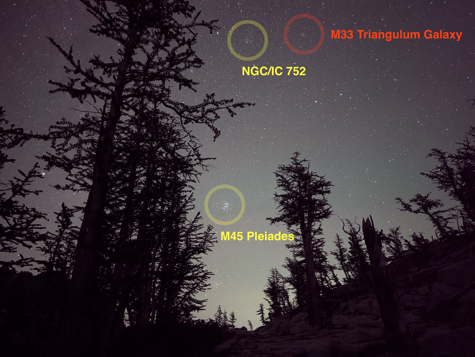
Day 5: From Upper Snow Lake past Nada Lake to Snow Lake trailheadThe night at Snow Lake was mired by terrible wildfire smoke. Ironically, it only affected breathing, not visibility. My eyes were itchy and the smokey odor was so challenging that I slept the entire night wearing an N95 mask, which was extremely uncomfortable, but every time I tried taking it off I found the smokey sensation insufferable. And yet, the sky was extremely clear. I got fantastic astrophotos of the Milky Way, in addition to M31 (the Andromeda Galaxy) and M33 (the Triangulum Galaxy). I broke camp early and headed out without breakfast, intending to stop along the way. I deliberately packed the breakfast food and cooking gear on top of the pack. The exit hike was uneventful. As intended, I stopped along the way for a cooked breakfast on the side of the trail. There were more opportunities to fill up water than I had learned in advance. The claim was that there is no water after Nada Lake but that isn't remotely true. There are lots of places where the creek is readily available with fast-flowing clean water, and this was late in the season. So I don't understand the descriptions that there is no water after Nada Lake. Oh well. I made the Snow Lake trailhead by noon, spent some time at the car straightening up, and then headed to Leavenworth for a burger and a shake right at the beginning of town. Either in objective or subjective terms, that was arguably the best milkshake I've ever had in my life. Pretty good burger too. 
ConclusionMany backpackers do the Enchantments in two or three nights. I did it in four, so I was aleady operating at the long end of normalcy, and yet my plan for a five night trip feels within reason. I didn't go up Prusik Pass and I didn't linger at Perfection Lake as long as I would have liked to. But given that the lottery is impossible to win, I will almost surely never go again. I might thru-hike it perhaps, but I presume that is such a rushed experience that you can't take your time along the way. Time till tell. |